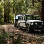
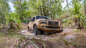
I thought the Anne Beadell Highway was tough, but the Connie Sue Highway smacked it down like The Rock on WWE. My sand flag was being smashed, stone guard attacked from below. Like witches clawing, my paintwork was being etched by…
I thought the Anne Beadell Highway was tough, but the Connie Sue Highway smacked it down like The Rock on WWE. My sand flag was being smashed, stone guard attacked from below. Like witches clawing, my paintwork was being etched by the tiny sticks that punched well above their weight. The Jeep Grand Cherokee behind me had gaffer tape protecting the side mirrors and snorkel, as ridiculous as it looked, was this a method that might work as a shield against what Connie was throwing at us? Click here to see the HEMA map.
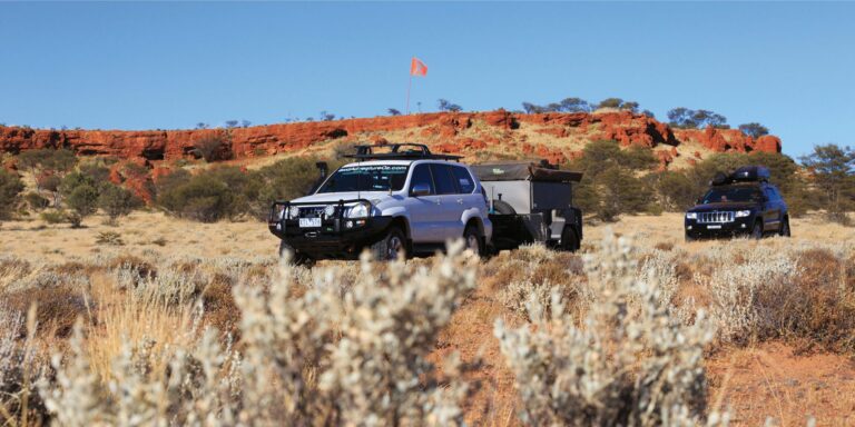
After filling the fuel tanks, we departed Ilkurlka Roadhouse and headed west along the Anne Beadell Highway. The grader had been doing some work for the first time since Len Beadell cut the track in 1953, and the going was good. The red sands of the Great Victoria Desert were blotted by spinifex and the occasional marble gum. A free camping area with water tank and pit toilet was soon reached; the Ilkurlka Community have spent considerable resources on the campsites in Spinifex Country.
Heading out to the plane wreck is a must; I dropped the camper trailer after the first dune, knowing I had 19 more to go before reaching the wreck. It helps to look after the track. As one of the most photographed sights on the Anne Beadell, it is worth including the 18km detour in your fuel calculations. As I hear it, the Goldfields Air Services plane crashed to the ground in 1993, with all persons surviving.
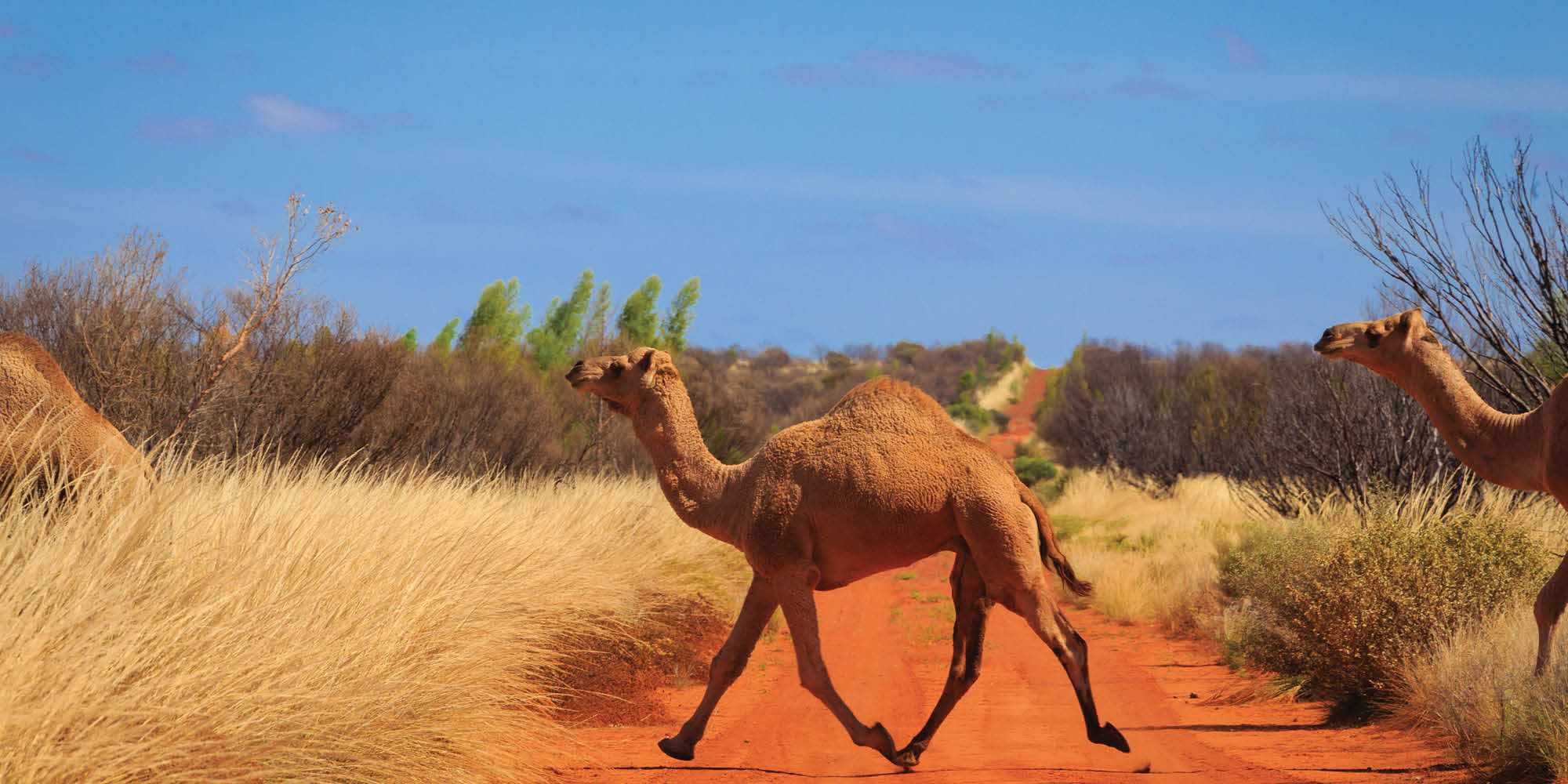
I was stopped by a herd of feral camels, the young ones reaching a gallop once they saw me. The bull bided his time, making sure his posse could cross the track safely. It gave me an opportunity to capture it all, the epic ‘camel running across in front of you’ shots.
I was stopped by a herd of feral camels, the young ones reaching a gallop once they saw me.
Next stop was at an Aboriginal ceremonial site to view a series of stone arrangements. It was hard to tell what was original and what had been arranged by travellers as I wandered the site. Neale Junction loomed, time for lunch and the end of the easy stuff. There is a campsite situated 200m west of the junction that is spacious with basic facilities.
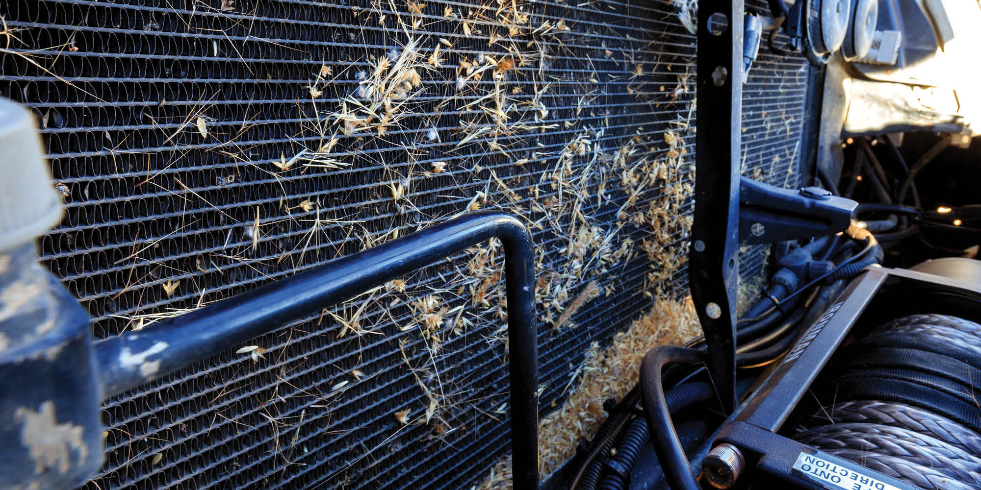
I had crossed the country via the Anne Beadell years before, but the Connie Sue Highway was a big unknown and boy did she throw up a challenge. The track north was great leaving Neale Junction; small versions of the marble gum on the side, evidence of recent burning was aplenty. Spinifex was also growing in the middle of the track; constant checking of the Prado underbelly ensured the oily grass wasn’t accumulating, creating a fire risk.
I’ve been collecting spinifex seeds
The Connie Sue Highway was first traversed by Len, Anne and daughter Connie Sue in July 1962 when they headed cross country from Warburton to the Anne Beadell Highway to meet up with the Gunbarrel Highway construction crew. Len and the GBH crew then graded a track north to Warburton then south to Rawlinna on the Great Australia Railway. By October 1962, the road was finished and named after his daughter. Connie Sue still runs tours along her father’s tracks.
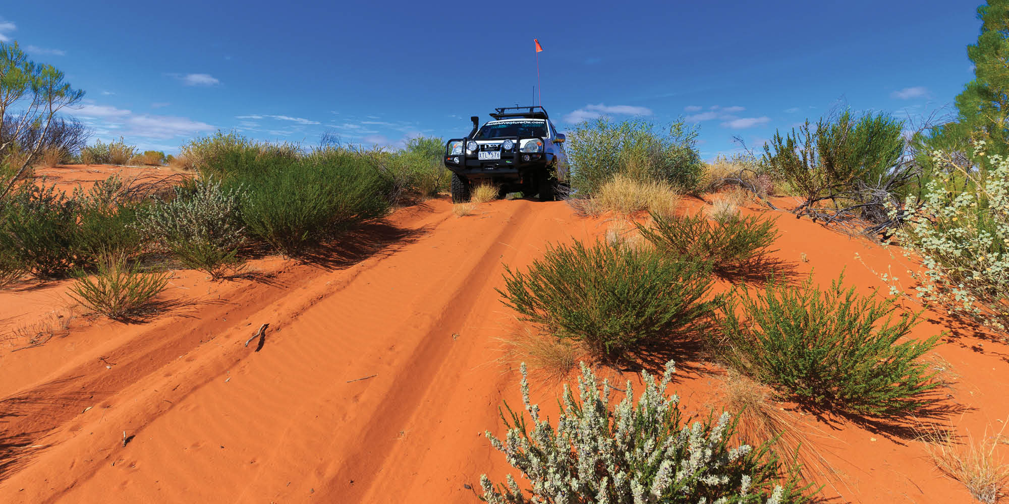
The track soon degenerated into such a state and speed dropped to between 20km/h and 40km/h. It was less than a hundred clicks to the Point Lillian turnoff, but it took over four hours. The track was deceptive – it would be perfect, then a washout would appear from nowhere; if you’d missed the detour track it could be a trip ender. I missed one and almost ended up in a 6ft sand blow. My clutch billowed black smoke, causing me some concern, as I reversed the Prado and camper back down the deep, sandy track.
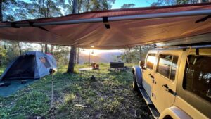
The turnoff to Point Lilian was indicated by an oil drum, the track heavily bound by spinifex … it didn’t look like anyone had been down this way for a while. The track wound through a copse of trees, the webs from golden orb spiders crossing the track. My bull bar and roof rack were covered in the silk-like webs but thankfully I didn’t have any eight-legged passengers. We set up camp in an open section that was free of spinifex in time to watch the sun set over the escarpments.
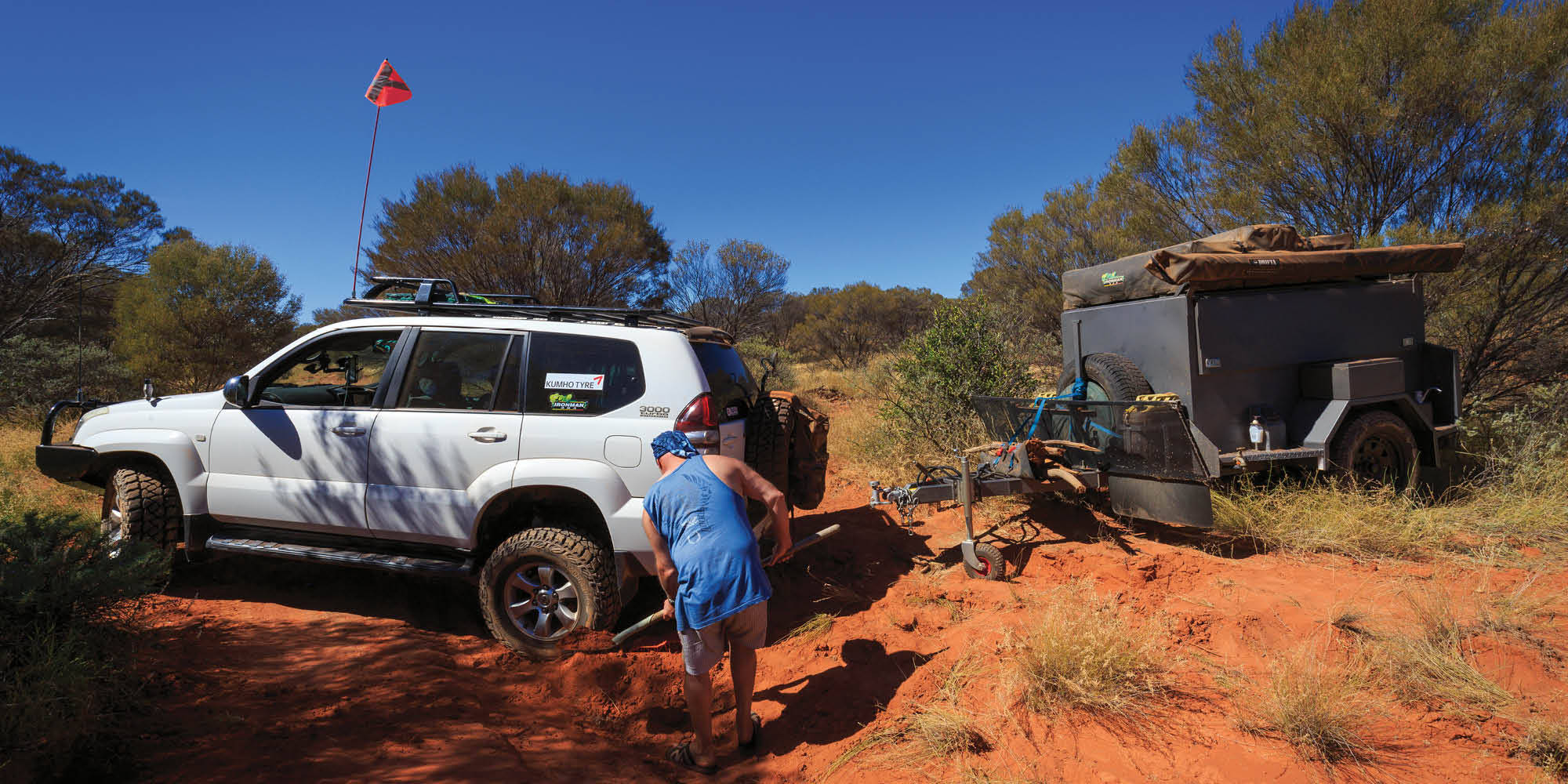
The going was slow again the next morning and I had to clear my undercarriage of dry grass. Half an hour later we reached the turnoff to Point Sandercock and the fun really began. The Jeep decided not to venture up the track as it appeared to have a guaranteed 100% scratchability rating. I continued on, suffering rim damage and an instant flat tyre on the camper within 500m. I was back on the track not long after, but the pressure gauge in my head had risen a few more points. I then made a big mistake.
I knew driving up this track solo wasn’t wise, and not unhooking the camper trailer a dumb move. The track soon became severely washed out, with no space to turn around easily. After a while, contact was finally made with the Jeep and I explained my recovery plan.
I had to reverse the camper up onto a flat section, unhitch it, turn the Prado around, drag the trailer around and then rehitch it. The Jeep arrived, and with a good degree of track building and physical manoeuvring, we succeeded in the recovery. Lesson learnt, trouble averted without any damage, pressure gauge low again.
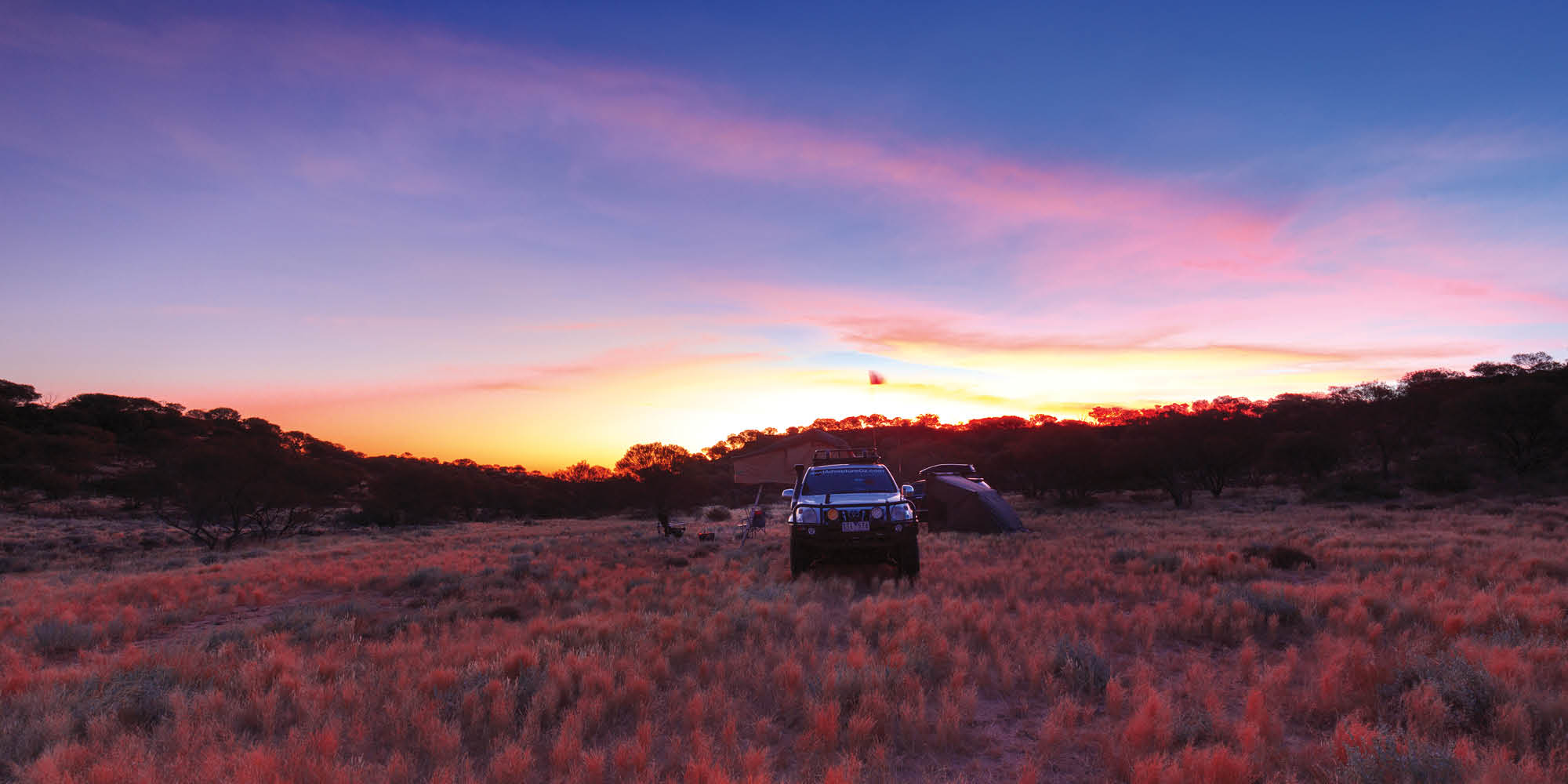
The next 200km took over six hours, with corrugations, washouts and track diversions slowing our speed. We climbed the escarpment at Mackenzie Gorge, the rocky road a change to what we had experienced. Connie Sue turned back to a sandy track soon after and the speed picked up as we closed in on Warburton. We reached the roadhouse just as the campground gate was being locked.
The track received a facelift to complete the recovery
Crossing the Great Victoria Desert via the Connie Sue was a superb challenge and I recommend it highly to those who love exploring the remote desert country and being totally self-sufficient. The landscape may not vary much, but the colours and the solitude make it a worthy destination. I am looking forward to completing the southern section soon.
Destination details
Region: The Great Victoria Desert. This is remote country and you will need to be well set-up and self-sufficient. There is little water available and fuel is only available at Ilkurlka and Warburton, a distance of over 500km.
Nearest Town: Warburton Roadhouse or Ilkurlka Roadhouse (both operate on WA time)
Best time of year: The cooler months, April to September
Permits Required: Connie Sue Highway – ngaanyatjarra.org.au
Accommodation/Camping Options
Ilkurlka Roadhouse: Bush camping with shelter, water, shower, drop toilet and BBQ (soon to have Optus coverage). The shop has limited basic supplies.
Paltju rockhole: Bush camping with shelter, water tank and drop toilet.
Neale Junction: Bush camping with water tank, shelter and drop toilet.
Point Lillian: Bush camping with no facilities.
Warburton Roadhouse: Powered or unpowered sites, cabins, toilets, showers, water, camp kitchen, Telstra coverage. The shop is well stocked with supplies.
Wonderful colours at Point Lillian
Advertisement
Unsealed 4x4
Unsealed 4X4 delivers honest 4WD advice, gear reviews, and travel guides crafted from real Australian adventures. Since 2014, we've tested the gear, driven the tracks, and learned what works - so you can hit the tracks safely.