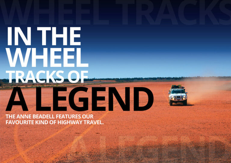
The sun was starting to dip below the horizon ahead of us, the softening light doing magical things with the reds, blues and greens that surrounded us. We were travelling along the Anne Beadell Highway – a rough and snaking track of great reputation that runs along the Great Victoria Desert, through very remote country that has hardly seen the harsh impact of human interaction.
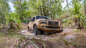
“Keep an eye out for a campsite,” Pat said, guiding the Patrol along the single-lane set of two wheel tracks that is the Anne Beadell. “Mind you, they’re pretty obvious when they do poke up.”
At this stage, we were a couple of days into the journey – having started from the opal capital of the world, Coober Pedy. After a couple of days the vast immensity of the land that surrounds you starts to finally sink in. It’s a funny thing; poring over maps and calculating distances gives you an idea of the size of the country you are planning to pass through, but it’s not until you physically travel through the land that you begin to understand it. Vast, endless, capacious, immense; adjectives don’t seem to cut it until you get out there, travel through it and experience the size for yourself.
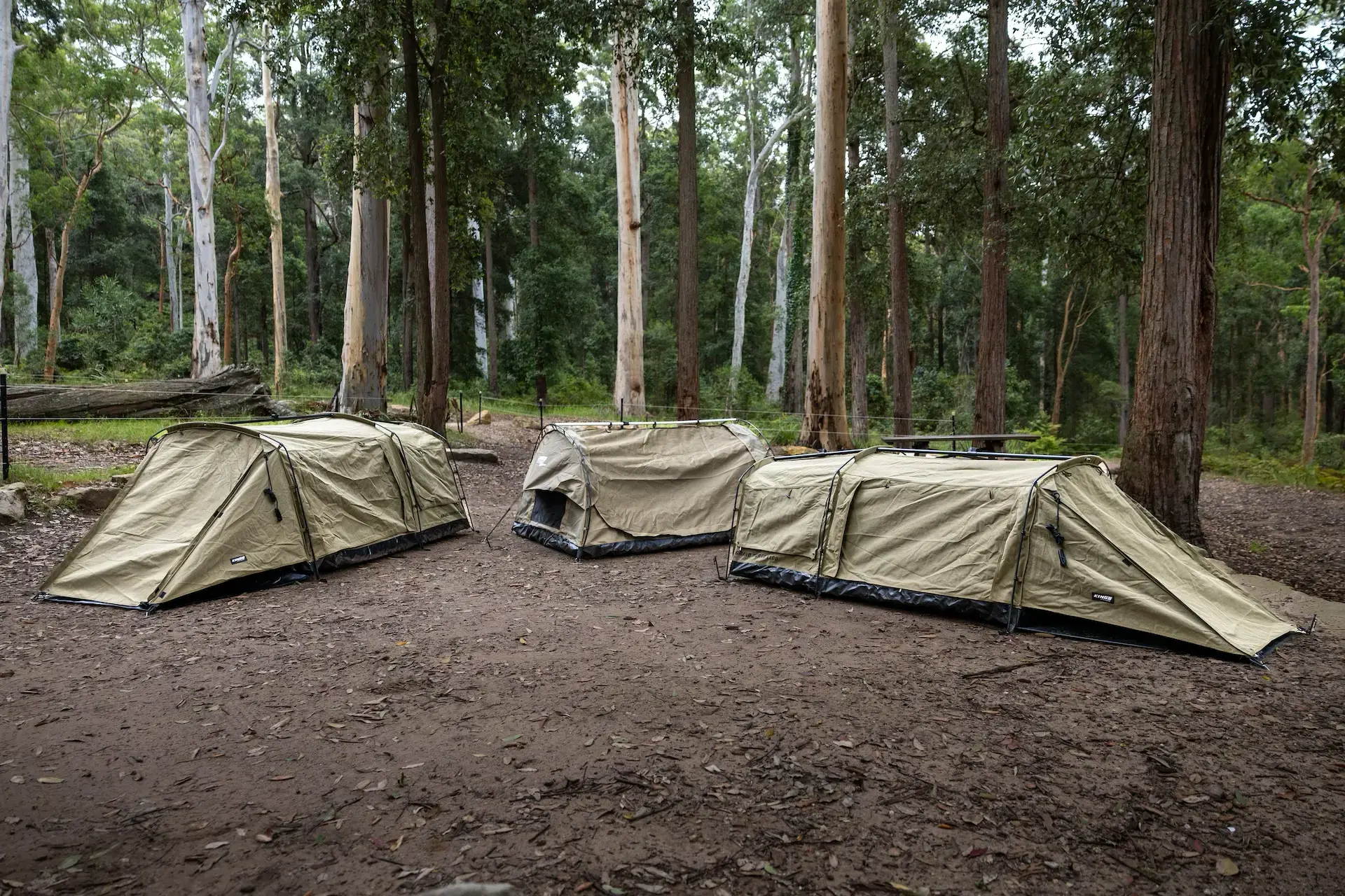
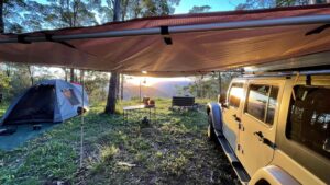
And sure enough, bleedingly obvious up ahead was a perfect clearing not far from the track waiting for us to set up camp. Campsites along the Anne Beadell are, in a word, idyllic. Amongst the spinifex and mulga there are frequent clearings of soft and flat soil, free of roots and rocks and ideal for rolling out the swags and setting up a campfire. There is enough dry wood around for modest fires, and sometimes you might score a desert gum or three for shade as well … or even a bit of a sand dune for wind protection and a ripper view in the morning.
One of the defining elements of this trip is the spinifex that really dominates the landscape. Sometimes forming intriguing round and snaking shapes that curl on indefinitely, spinifex is a pretty impressive plant in itself. It is perfectly at home in these hostile conditions. Different from the coastal spinifex genus, the inland stuff is actually called Triodia. It’s an incredibly hardy plant, which is famous for thriving in the most inhospitable areas. Containing high amounts of silica and resin, it burns hot with thick smoke when set alight. A vicious burning doesn’t kill the plant though, as a root system can go as far as seven metres deep into the soil – finding nutrients and water far below the surface.
Travelling these spinifex-laden plains does come with a little bit of danger that all travellers should be aware of. High amounts of oily resin and low amounts of moisture in the spinifex plant means two things: One, the plant is quite easy to set alight; and two, once it’s going, there is no stopping it. It’s great for grabbing a small handful to help kick over the campfire, but it presents a real risk when potentially coming into contact with your hot vehicle’s components. Sticking to the established tracks and using your common sense is usually enough to steer clear of trouble, but it is still something to be aware of. It definitely doesn’t hurt to periodically check underneath your car – paying close attention to spinifex build-up in the nooks and crannies of your suspension and chassis.
If you have travelled the desert, you’ll know how much of a paradox it can be. When it’s easy to think of a desert as a desolate wasteland void of life, that really couldn’t be much further from the truth. Wedgetail eagles soar majestically above, and can also be spotted resting in the trees that dot the landscape. Lizards scamper between the sparse cover underfoot, and wildflowers catch your eye with amazing colours right along the track. A legacy of early pioneering days through Australia’s arid interior, camels are also frequently spotted in these parts.
The majority of the Anne Beadell Highway sits in the Great Victoria Desert, which conservative estimates put at around 350,000 square kilometres, or five per cent of Australia’s total land mass. In other words, it’s got a bit of size about it. Aside from the Aboriginal populations that have inhabited this part of the world since ancient times, the first explorer to cross the Great Victoria Desert was Ernest Giles back in 1875. After almost succumbing to the hostile Gibson Desert (which was named after Alfred Gibson, who died on the expedition), Giles then travelled to Port Augusta before taking a westerly bearing, crossing the Great Victoria Desert and finally ending up in Perth. The next big things to hit this part of the world were a larrikin, an old Land Rover, and 16 kilotons of atomic bombs.
There’s good handful of sights along the 1,300-odd kilometre length of the Anne Beadell, but one you cannot miss is called Emu. Here at the site of two atomic bomb tests (back in 1953), now stands two eerie obelisks on the spot where the bombs were set off. There is plenty of evidence of the explosion: Vitrified sand (that has been heated to melting point), and bent and gnarled metal plates and bolts. These would have once been the structures that held the atomic bombs (named Totem 1 and Totem 2) aloft, 30 metres up in the air. The turnoff is around 15 kilometres east of Emu junction, and it can be missed if you aren’t paying attention.
The name ‘Emu’ comes from the claypan that Len Beadell used as an airstrip to allow incoming British military figures and scientists to land and survey the area before testing began in earnest.
“What’s those footprints over there?” asked one of the scientists.
“Emus,” replied Len, and the name stuck.
Interestingly, although the area is safe to visit, lingering levels of radioactivity mean that Emu is too dangerous for permanent habitation.
Further along the track, you will come across a startling change of scenery at the Serpentine Lakes. Cresting a hill, you are quickly greeted by the vast and flat expanse of an ancient drainage system dating back to the Palaeozoic era. The track crosses the northernmost point of this system, which stretches for around 100 kilometres in a southerly direction. Sticking to the track here is sagely advised. The pan itself can quickly turn into a quagmire when a 4X4 breaks through the soft crust.
Passing the Serpentine Lakes means you are close to the border of South Australia and Western Australia; the new gleaming signs looking decidedly out of place in the desert, especially after days with almost no signs of civilisation. Nearby, you will see a humble 44 gallon drum which used to belong to Len – now serving to hold up a pressed aluminium plate with the inscription of the border, co-ordinates, and basic instructions. Most importantly, it is signed ‘Len Beadell, April 1962’. There are constant reminders of Len’s influence on this route; and that influence cannot be underestimated. Trig points stand proud atop outcrops and tall dunes, and gibber rocks form crosses alongside the track. Len did all of his survey work with the aid of his trusty theodolite, the stars above, and his immense skills as a surveyor. In fact, modern surveyors equipped with GPS equipment have checked Len’s markings and measurements … and found them all to be spot on.
Touted as one of the most remote roadhouses in Australia, Ilkurlka Roadhouse stands as your only refuelling point along the Anne Beadell Highway. It is about as close as you can get to the middle of nowhere. You will have travelled 780 kilometres from Coober Pedy to get here, and there is another 500-odd kilometres to look forward to before hitting Laverton where the Anne Beadell ends. Aside from fuel, Ilkurlka offers the opportunities to restock basic supplies and peruse some terrific artworks and souvenirs made by the local Spinifex people. If you didn’t set up camp here, you would have to be half mad. Sprawling campgrounds of simple structures, basic facilities, and the most wonderful donkey shower you might ever have in your life, makes it an absolute must. Collect some wood for the charming barrel barbecue, and watch the sun disappear over the lustrous red sand for an unbeatable camping experience.
Leaving the hospitality of Ilkurlka Roadhouse behind, roughly 95 kilometres down the track will see you at Neale Junction. Before Neale Junction is a worthy 10 kilometre diversion to a wreck of a light plane that came down in 1993. It was a Goldfields Air Services flight, which remains remarkably intact considering the situation. All on board at the time survived.
A sprawling flat intersection with a thick white post standing proudly in the middle (with some old cross-ply tyres sitting around the base, of course), Neale Junction is where the Anne Beadell Highway intersects with the Connie Sue Highway that runs between Warburton in the north and Rawlinna in the south. There is a visitors’ book in a box that is great to flick through and make an entry of your own; and the marker is a great one (even the dogs get a mention).
After Ilkurlka, road conditions get much better. A grader goes over this part of the highway every now and then, so you aren’t committed to rough conditions experienced earlier on. If you were concerned about how slow progress was at the start, you’ll be happy to know you can make up time on this part of the track if you are in a hurry. You will soon go past Bishop Riley’s Pulpit, a stark outcrop of red and ochre that pops out from a flat horizon. There is a campground here if you are so inclined, and the landmark makes for some terrific photos and views.
Next stop is Yeo Outstation sitting just south of Yeo Lake. An abandoned homestead that was once surrounded by the prized sandalwood, the house itself is now maintained by the Department of Parks and Wildlife (previously the Department of Environment and Conservation), and it is open for camping. There is a great fireplace here, along with a very charming bush shower next to the original homestead. There are also some long-drop toilets. We didn’t camp at Yeo Outstation, however. We pushed on to ‘Yamarna’ – another old outstation that is marked as abandoned, but looked to be back in use when we came through. From there, the road was as smooth as silk and as wide as an undivided highway all the way to Laverton.
The trip wasn’t over yet; there was one more compulsory stop in Laverton: The Explorer’s Hall of Fame. The place does a nice coffee, and is full of stories from all of the great Australian explorers – from early examples like John Forrest right through to the legendary Len Beadell.
PERMITS AND INFORMATION
You will need permits from the following groups to do the complete Anne Beadell Highway:
Maralinga Tjarutja Land:
https://www.maralingatjarutja.com/
43 McKenzie Street, Ceduna SA 5690
Tel: 08 8625 2946
Fax: 08 8625 3076
Email: senioradmin@maralinga.com.au
Mamungari Conservation Park:
https://www.environment.sa.gov.au
Tel: 08 8625 2946
Fax: 08 8625 3076
Email: senioradmin@maralinga.com.au
Tallaringa Conservation Park:
Entry & camping permits can now be purchased online from the following link:
https://www.parks.sa.gov.au/find-a-park/Browse_by_region/flinders-ranges-outback/tallaringa-conservation-park#fees
Or you can still call the Port Augusta Office on 08 8648 5328 if you prefer to book over the phone.