Advertisement
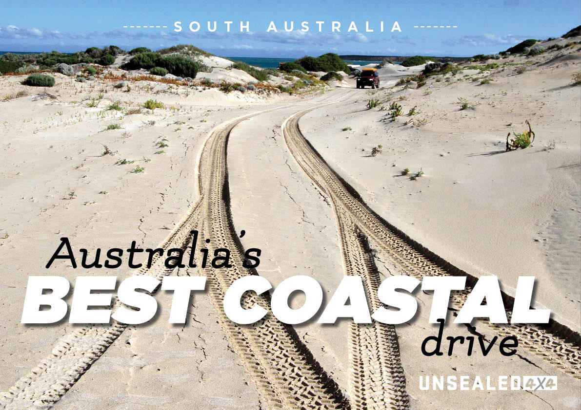
We live on a big island, so there is a lot of coastline to explore – but Vic Widman reckons this stretch in South Australia is possibly the best.
There is no question that we have some simply amazing coastal landscapes to explore around Australia. Finding the best would be a dream job… and I’m not giving it up. There are in fact so many simply stunning spots it will be quite contentious to single out one; but hey, I’m not frightened of being contentious, so here is my idea of the best coastal drive. Being a four-wheel driver I’m looking for scenery, facilities, fuel, accommodation, beach driving and (to round it off) beach camping. If we can mix all that together, we’ve got the best in my opinion… and I say the stretch from Streaky Bay to Fowlers Bay ticks all those boxes.
To start off let’s locate exactly where I am talking about. Take a look at the HEMA map on the western side of Eyre Peninsular. Approximately 390 kilometres west of Port Augusta just off the Eyre Highway you will reach the coastal town of Streaky Bay – named by the mariner Matthew Flinders in 1802 because of oily streaks he witnessed in the large bay. The oil streaks were created by the seaweed and not some Exon disaster. Streaky Bay is a delightful seaside resort these days, with a nice hotel in the centre of town and the aptly-named Foreshore Caravan Park (as close to the water as any million-dollar real estate).
If your visit coincides with some big wave action, as my recent trip did, make sure you make your way along the coast near Cape Bauer as there are some incredible whistling blowholes along the limestone cliffs that front the raging waters of the Southern Ocean. There are a couple clearly-signposted car parks and walking tracks down well-made boardwalks that lead to the coastal views and the hissing and snarling rock holes. If the water is calm, be patient… as eventually a big wave will strike the cliffs below and send your hat high in the air if you get too close to the small crevices around your feet.
Next stop is Ceduna (via Smoky Bay to stock up on the famous oysters). This is the last major town before the long 1,200km drive over the Nullarbor Plain to Norseman. You can use Ceduna as a base for a couple of days or simply restock for a few days of beach camping. Either way, be aware that just west of Ceduna you pass through the quarantine checkpoint on the Eyre Highway.
No fresh fruit, grapevines or honey products purchased west of Ceduna can be brought back east
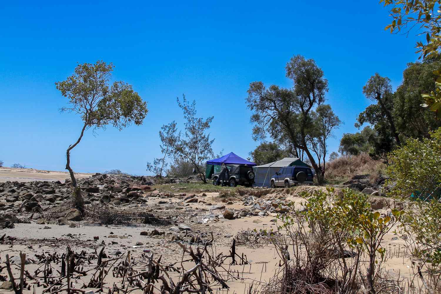
Just past the roadblock take the side road to Denial Bay and check out the very long jetty stretching into the bay opposite Ceduna, where the fishing can be pretty good. But my suggestion for the avid tourer is to continue on the unsealed road around the bay foreshore to the area known as Davenport Creek. You will arrive at a small car park with sand dunes on your right and the mangrove-lined waters of Davenport Creek on your left. You will need to drop your tyre pressures at this point before proceeding into the soft white sand.
Advertisement
The track leads through low sand dunes but they soon grow in stature to giant mounds of soft powdery grit.
There is an official camping area in the dunes complete with a drop toilet; no fees, just find a spot in the swale between the giant dunes to set up camp for a few days. Apart from the fun of sand driving, Davenport Creek is a fisherman’s paradise. I also highly recommend following the sandy tracks to the very end of the headland known as Point Peter. The track climbs through low scrub and limestone outcrops with some great views over the wide bay back to Ceduna. At Point Peter itself you can stand atop an undercut sea cave and watch the thunderous waves from the Great Southern Ocean pound into the craggy rock platforms beneath your feet – a fabulous spot for sure.
Advertisement
After Davenport Creek, continue west along the Eyre Highway to the town of Penong – the windmill capital of Australia. Fifteen years ago this town had at least 150 working windmills; these days they’re a bit of a tourist attraction and worth the look. Head due south out of town towards Point Sinclair and on the way you’ll cross between two lakes (one of which is a bright pink colour created by the high salt content of the waters).
Just past the lake is a small privately-run camping ground set in low sand hills. It is here that you could easily be rubbing shoulders with some of the world’s greatest surfing champions because just behind the site is Cactus Beach. This is a place regarded the world over as one of the best surf beaches anywhere. Just up over the hill on the main road are Point Sinclair and Port Le Hunte with its wide bay, netted swimming area, old shipwreck and historic jetty.
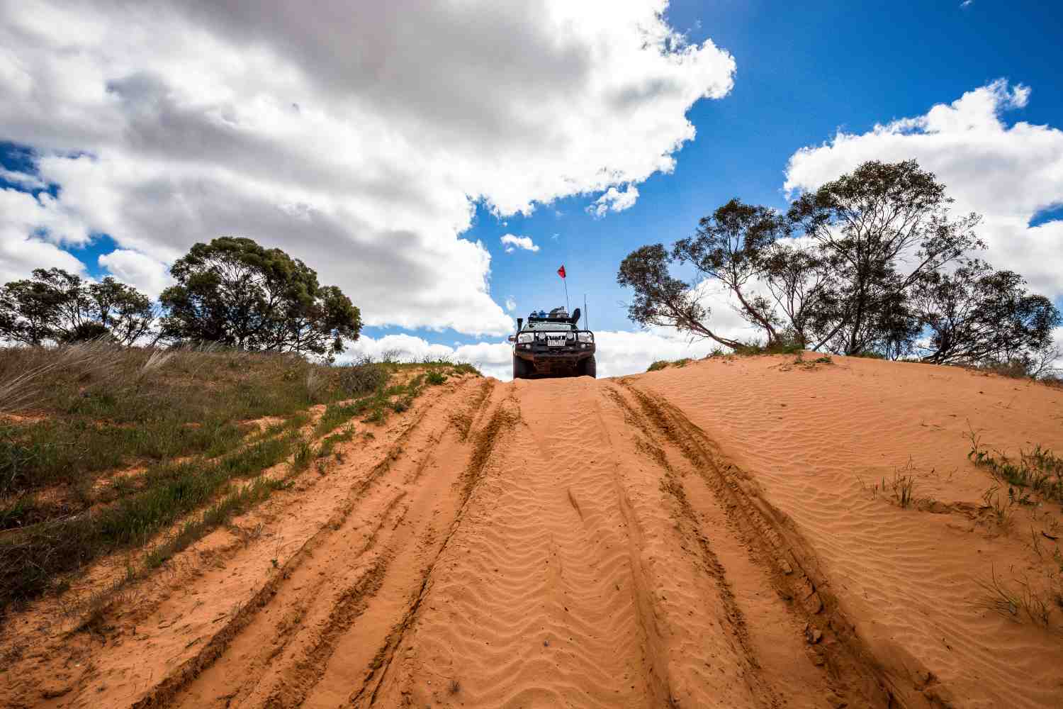
Sixty kilometres further west again, and just off the Eyre Highway, is the cream on the cake: Fowlers Bay. The caravan park in the centre of town is great and a couple minutes drive away is sand dune driving that even surpasses Davenport Creek. Some may find it a challenge to get up the first giant dune, but with tyre pressures around 15psi you should be OK.
As always, be careful of the very steep drop-offs. You can find your way through the dunes all the way to the beach, which (on a low tide) you can drive for several kilometres all the way west to view the rocky outcrop just offshore known as Mexican Hat. Back at the eastern end is another headland with a tight and somewhat scratchy track that leads to the cliffs that look down on sea lion colonies, and the old stone remains of the whaling station that once operated here.
Like I said, there are many great coastal drives in Australia – but few combine as much scenery, fishing and fabulous sand driving as the coast found in South Australia east and west of Ceduna.
Advertisement