Advertisement
You’re itching to get the 4WD dirty but don’t have weeks to trek to the Outback? Sydney’s backyard is packed with excellent 4WD tracks that you can tackle over a weekend or even a day trip. We’ve rounded up 10 tracks near Sydney that deliver real adventure – from beach runs to bush climbs – all within a few hours of the city. We’ve updated the list for 2025 to make sure every spot is actually open today. Whether you’re building confidence or seeking new challenges, these tracks offer something for everyone.

1. Watagans National Park
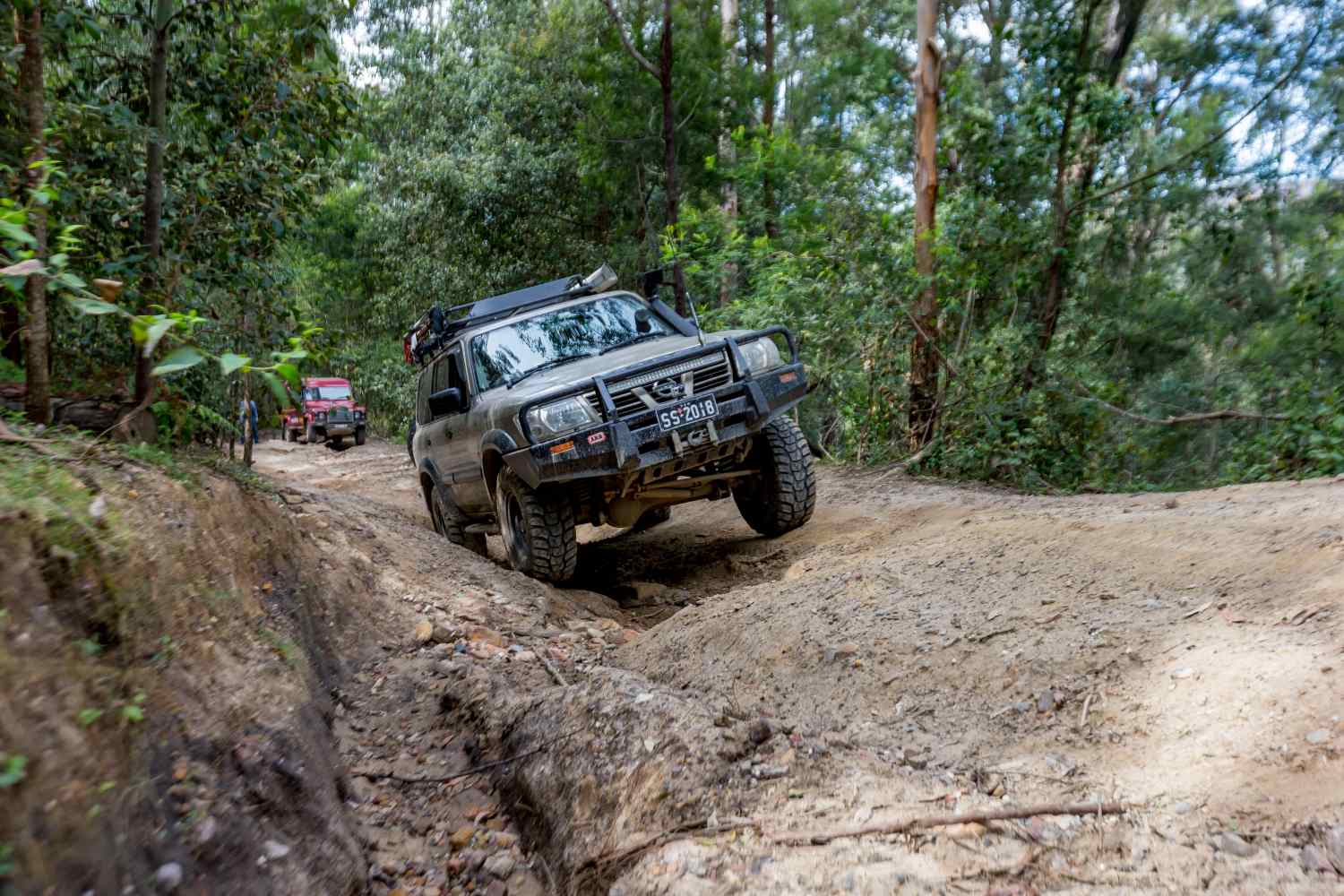
Don’t let the proximity to suburbia fool you – the Watagans offers some of the most challenging four-wheel driving within reach of Sydney. From muddy bog holes to rocky climbs and scenic forest trails, this place has it all. Located about 2 hours north of the CBD, the Watagans is a network of state forest and national park tracks in the hills behind the Central Coast. You can spend all day exploring and still not cover it.
If you’re after a challenge, try Daniels Point Road – it’s a notorious hill track with clay sections that become extremely slippery when wet. In dry weather, there are fire trails winding to lookouts like Heaton and McLean’s – perfect for taking in views and spotting wildlife. The beauty of the Watagans is feeling remote while being only a short drive to town if you need supplies.
The Watagans also offers plenty of family-friendly camp spots. Gap Creek Campground is a top pick with basic facilities in a stunning rainforest setting, plus a short walk to Gap Creek waterfall. There’s also Watagan Headquarters campsite which is more open and great for groups. You can tackle muddy loops in the morning, then head off to Hunter Valley or the coast for an afternoon swim.

How to get there
Head up the M1 Pacific Motorway and take the Palmers Road exit towards Freemans Waterhole. From there, follow Watagan Forest Road which climbs into the park. The main dirt roads are well signposted. For Daniels Point Road and the tougher tracks, navigate to Prickly Ridge Road or Bangalay camps and follow local trail markers. GPS or offline maps will help as the forest is a maze of intertwining trails.
What you’ll need
The Watagans range from easy gravel roads to hardcore mud pits, so bring recovery gear – at least a snatch strap and shovel. In winter or after rain, mud-terrain tyres will make life much easier, particularly on Daniels Point Road. In dry weather, stock 4WDs can handle many trails here, but always travel with a mate or be confident self-recovering. Pack insect repellent in summer, plus water and firewood for camping. The nights can get cool in the hills, so bring warm sleeping gear.
2. Wingello State Forest
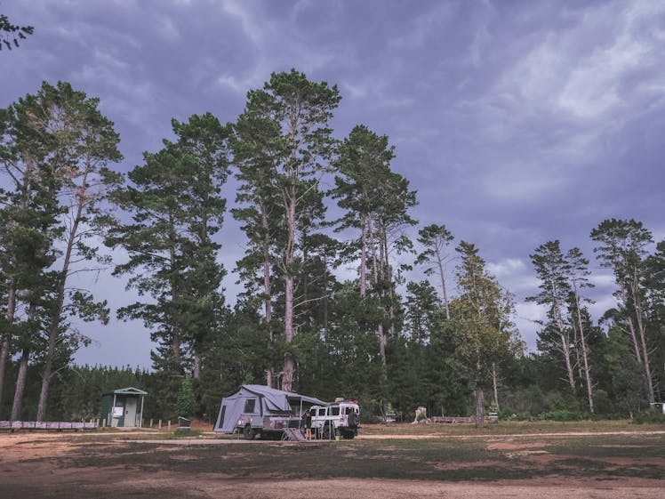
About 1.5 hours south-west of Sydney, Wingello State Forest is a pine plantation offering easy, enjoyable tracks perfect for beginners or anyone looking for a relaxed weekend escape. The trails here are mostly flat or gently undulating dirt roads weaving through plantation pines and native scrub. It’s a choose-your-own-adventure kind of place where you can explore unmarked forest trails and find quiet clearings or fun little challenges to test your 4WD skills.
Wingello is excellent for camping. There’s a free camp called Dalys Clearing right in the forest with basic bush camping facilities – long-drop toilets and fire pits. You’re camping among pine trees and waking up to crisp highlands air. Because it’s state forest, you can collect fallen timber for your campfire. On clear nights, the stars are spectacular. Bundanoon and Penrose villages are a short drive away for coffee or a pub feed.
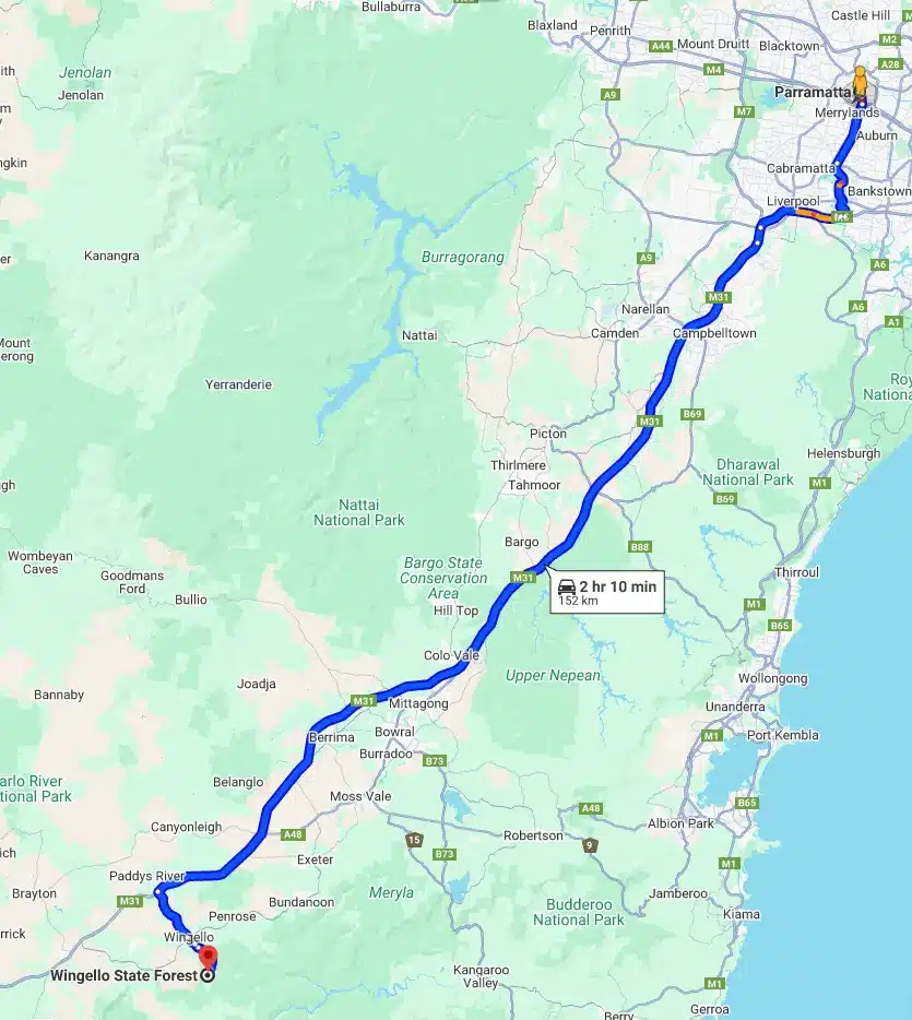
How to get there
From Sydney, take the Hume Highway and exit at Wingello/Bundanoon. Once in Wingello village, follow Forest Road out of town – within minutes you’ll see the pine forests and signage for Wingello State Forest. Dalys Clearing campground is about 5km into the forest with signs directing you. The forest has a mix of main gravel roads and smaller side tracks. Most intersections are unmarked, but keeping mental notes or using breadcrumb mapping on your GPS makes navigation straightforward.
What you’ll need
Wingello is low-risk – in dry weather, a stock SUV or ute will handle the main trails without issues. After heavy rain, clay sections can get slippery, so all-terrain tyres and 4H mode are wise. Always carry recovery basics (shovel, strap) just in case. There’s zero phone reception in parts of the forest, so having a UHF radio to chat with your convoy or a GPS communicator is handy for safety. Nights get cold year-round in the Highlands, so bring warm gear. Pack what you need in terms of water, food and first aid. Respect the forest rules – Wingello is popular for mountain biking and hiking too, so drive slowly near trail crossings and leave gates as you found them.

3. Barrington Tops National Park
High up on the Barrington plateau, about 3.5 hours north of Sydney, you’ll find sub-zero nights, forests of ferns and snow gums, and some excellent 4WD-only trails. This is a place where you can drive from rainforest to snow in the right season. The crown jewel is the Barrington Trail – a 4WD track that’s open seasonally (it closes in winter to prevent track damage). When open (usually October to May), this trail takes you deep into the park, past pristine creeks and campgrounds like Junction Pools and Little Murray.
The trail isn’t particularly hard in dry conditions – any high-clearance 4WD will make it – but it is remote. The trail skirts steep mountainsides and fords a few shallow rivers, giving you that genuine wilderness experience. If you want more challenge, there are side trails like Thunderbolts Trail or Rocky Crossing that can test your low-range skills with steep climbs and ruts. Check park alerts, as some sections were still closed for repairs as of late 2025.
Barrington Tops can be as relaxing or challenging as you want. Set up at Polblue campground – it’s huge, grassy, and often visited by wild brumbies at dusk. Prefer a cabin? There are farmstays and lodges in Gloucester or Moonan Flat at the base of the mountains. During the day, you can fish in a trout stream, tackle a short hike to a lookout, or simply brew a cuppa and take in the silence.

How to get there
There are two main routes up the Barringtons. From the south (Sydney side), drive to Gloucester via the Pacific Highway and Bucketts Way. Gloucester is your last fuel stop. From town, head up Thunderbolts Way and then onto Barrington Tops Forest Road – this becomes gravel and climbs into the park. The other route is from the west via Scone/Moonan Flat, taking Barrington Tops Forest Road from that side. A popular route is to traverse the Barrington Trail across the tops – note it’s closed June–September, so plan for an October-May trip. It’s a solid day’s drive across, so start early. Always check NPWS alerts before departure.
What you’ll need
Because Barrington Tops is true high-country, prepare like you’re heading to the Snowies. Even in summer, the weather can turn cold and foggy without warning. Pack warm clothes, rain gear, and extra food in case a fallen tree means an unexpected overnight stay. A proper spare tyre (or two) is smart – the rocky trails can stake a tyre, and help is a long way off. You’ll need a decent clearance 4WD; something like a stock Prado or Pajero is fine. Recovery gear is essential if you’re doing side tracks or if it’s been wet – parts of Barrington Trail can get boggy. Bring a small air compressor to adjust tyre pressures. Finally, check that the trails are open before you go via the NPWS website to avoid disappointment at a locked gate.
4. Yalwal (Danjera Dam area)
Tucked west of Nowra, about 2.5 hours from Sydney, Yalwal serves up steep rocky climbs, muddy play areas, and a beautiful dam to cool off in or fish for bass. It’s the kind of spot that South Coast locals quietly enjoy while crowds head north. The main focal point is Danjera Dam. You’ll drive in on a winding dirt road that suddenly opens up to a gorgeous lake surrounded by bushy hills. Note that as of now the dam is day-use only – camping at the water’s edge is no longer permitted.
Yalwal’s got range. If you’re an experienced 4WDer seeking a serious challenge, the infamous Monkey Gum Fire Trail is nearby. It’s regarded as one of NSW’s toughest, with rock steps and bog holes that will challenge even built trucks (lockers and lift strongly advised). Same goes for Six Stage Hill. But if you’re after something more manageable, Yalwal has that too. There’s a powerlines track in the area that’s perfect for honing your skills – a few ruts, a few rock ledges, nothing too extreme. General exploring on forest trails around the dam is great for stock 4WDs.
With the dam campground closed indefinitely, you have two options: find a dispersed bush campsite in the state forest (away from the dam – there are a few flat clearings along the 4WD trails where camping is still allowed), or head back towards Nowra where there are holiday parks. The area is cleaner and quieter now, and you’re more likely to have the tracks to yourself.

How to get there
Make your way to Nowra via the Princes Highway, then head west towards the village of Yalwal, following Yalwal Road and signage to Danjera Dam. The last 25km is unsealed, winding road – it’s graded and 2WD-accessible in dry weather, but take it slow as it’s narrow and used by various vehicles. You’ll descend a hill and cross a causeway into the Danjera Dam picnic area. This is the main trailhead. Monkey Gum Trail branches off Yalwal Road earlier (closer to the highway at Yerriyong) – access via Braidwood Road. The Powerlines track and other spurs can be found by exploring the forest roads around the dam.
What you’ll need
For Yalwal itself and the moderate trails, a stock 4WD with decent all-terrain tyres will suffice. Bring your recovery kit in case a rut or muddy patch gets the better of you. If you plan to tackle Monkey Gum or Six Stage, that’s different: you’ll need a well-equipped vehicle (lift, mud tyres, recovery points, winch) and ideally a second vehicle as support. Those tracks are winch-fests in wet weather. Carry plenty of water – it can get hot in summer. A tyre deflator and compressor are useful. Pack out what you pack in – the area has had issues with litter, and we don’t want to lose more access.

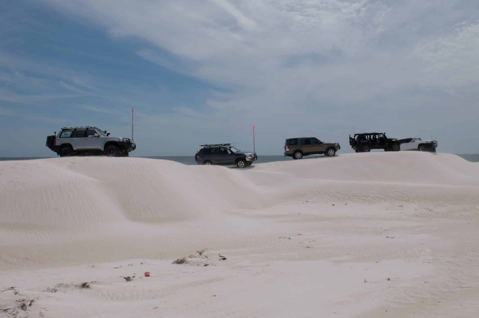
5. Blacksmiths Beach (Nine Mile Beach, Lake Macquarie)
Blacksmiths Beach – part of Nine Mile Beach at Lake Macquarie – is an excellent spot to get some sand driving experience without a big expedition. It’s only about 1.5 hours north of Sydney, just past Newcastle. This is a proper designated 4WD beach where you can legally drive on the sand for several kilometres, park up, fish, BBQ – as long as you’ve got your permit sorted. The beach itself is usually beginner-friendly: wide, flat, and with relatively firm sand, especially at low tide.
What makes Blacksmiths special is how accessible it is. You’re right next to suburbia, yet when you’re cruising along with the ocean on one side and dunes on the other, you’ll feel a world away. It’s a popular family spot with everything from old LandCruisers to shiny new Rangers, loaded with kids, dogs, and fishing gear. Pull up anywhere along the high tide line and set up for a swim or surf. Just be mindful of the rules – this beach is part of Belmont Wetlands State Park and they do enforce the permit system and no-go zones for dunes.

How to get there
Head north on the M1 and take the Newcastle exit, following signs to Belmont/Swansea. Blacksmiths Beach 4WD entrance is at the Awabakal Avenue access point in Blacksmiths near the Granny’s Pool area. There’s a gatehouse where rangers may check your permit. Once on the beach, you can drive north towards Redhead with exit points at Kalaroo Road and 3rd Creek. It’s two-way traffic on the sand, so watch for oncoming vehicles and stick to the left (ocean side when heading north).
What you’ll need
Number one: a 4WD beach permit. As of 2025, you can buy it online via Belmont Wetlands State Park – options range from a weekly pass (~$45) to an annual pass (~$110). Rangers patrol and will fine you $220 on the spot if you’re unregistered. Air down your tyres to around 15-18 psi before hitting the sand (bring a tyre deflator and air compressor to pump back up). A snatch strap and maxtrax are good insurance in case you or someone else finds a soft patch. Drive to conditions: Blacksmiths is generally easy, but avoid sharp turns and heavy braking on soft sand. Check tide times – it’s best to drive at mid-to-low tide when there’s plenty of firm sand. No glass on the beach – bring cans or cups and take rubbish with you.

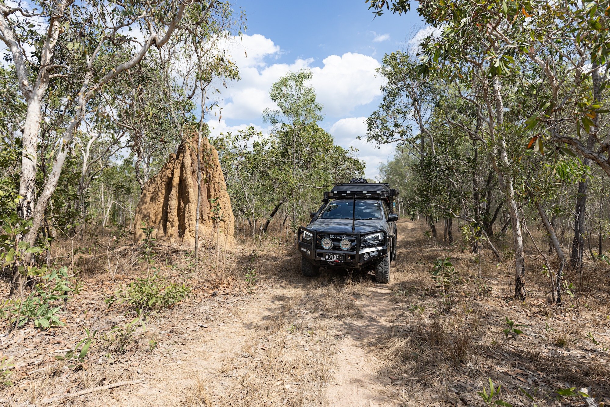
6. Colo River (Wheeny Creek & Upper Colo)
Hard to believe this wilderness is just over an hour from Sydney, but the Colo River region is like stepping back in time. This is the last truly pristine river in NSW, and around its banks are a mix of national park and rural lands laced with 4WD tracks. For Sydney-based drivers, the Upper Colo and Wheeny Creek area is perfect for a quick escape that still feels remote. Expect towering sandstone cliffs, clear river pools, and some rugged tracks that’ll put your vehicle through its paces.
The main action is on the Wheeny Creek Trail / Comleroy Road area. Head up to the Wheeny Creek campground (a lovely free campspot by a creek, though popular on weekends) and you’ll find offshoot tracks with rocky sections and clay ruts. One well-known trail is Gees Arm South – a fire trail that descends towards the Colo River through Wollemi National Park. It’s steep with erosion mounds, ending at a small clearing above the river. It’s a real low-range workout coming back up, but the views and remoteness are worth it.
For camping, Upper Colo Reserve is a council-run campground right on the Colo River and it’s excellent: grassy sites, toilets, cold showers, and top-notch river access for swimming or kayaking. It’s dog-friendly too (just keep your dog out of the adjacent national park). You need to book online through Hawkesbury Council, and it fills up quickly on holidays. Another option is the NPWS Wheeny Creek campground – tucked in the bush with a creek running through. Upper Colo Reserve is hard to beat for convenience and scenery – sitting by the campfire under a blanket of stars while the Colo River flows by, knowing you’re barely 60km from Sydney CBD.

How to get there
Head towards the Hawkesbury region. From Sydney, drive to Kurrajong via Richmond, then take Bells Line of Road before turning off to Upper Colo (Upper Colo Road). If going to Wheeny Creek, turn off at Kurrajong onto Comleroy Road and follow it north into the Wollemi foothills. Comleroy becomes a dirt trail that leads down to Wheeny Creek campground (signposted). For Upper Colo Reserve, navigate Colo Heights Road to Hulbert Road – it’s well signposted. Both routes involve narrow, winding gravel sections. Gees Arm South trail is accessed off Comleroy Road – look for a gate and trailhead about 2km before Wheeny Creek campground. Always bring a map or GPS, as mobile signal can be patchy.
What you’ll need
A moderately equipped 4WD is fine for the Colo – something with decent clearance because of the ruts and rock ledges. If you stick to main roads (like Mountain Lagoon Road or the road to Upper Colo Reserve), an AWD could manage in dry weather. But for the interesting trails, you’ll want low range. Tyres aired down to ~20 psi will smooth the ride over rocks. Recovery gear is sensible – a sudden storm can turn clay to slop. Bring insect repellent – the mozzies along the river are persistent. Don’t forget supplies: fuel up in Richmond or North Richmond, and stock up on food and firewood. The campsites have zero facilities beyond toilets. Mind the pet rules: you can bring dogs to Upper Colo Reserve or private sites, but absolutely no pets in Wollemi National Park territory.

7. Abercrombie River National Park
Abercrombie River National Park might only be 3.5 hours from Sydney (past Goulburn/Oberon), but it feels like the middle of nowhere. This place is all about deep valleys, river crossings, and steep 4WD trails that wind through eucalyptus forests. It’s the kind of park where you won’t have phone service, you probably won’t see another soul mid-week, and the stars at night are spectacular.
The main highlight is the Abercrombie River itself – a gorgeous, clear river that cuts through rugged terrain. There are established campgrounds along the river (the Beach, Silent Creek, Bummaroo Ford, and The Sink), and reaching them is half the fun. To get to The Beach campground (a local favourite), you’ll descend via Middle Fire Trail or Bald Hill Trail – both are proper low-range drives with steep sections and rock ledges. When you reach the river, you’re greeted by an awesome sandy bank and usually kangaroos or deer wandering by. Bald Hill Track from the top is steep and exposed, testing your engine braking on the way down and traction on the way up. Another must-do is crossing the river at Bummaroo Ford – it’s a wide shallow ford that’s normally easy, but after heavy rain the river can rise significantly.
Abercrombie is for those who really want to get away from crowds. Don’t expect facilities beyond a pit toilet at some campgrounds. This is pack-it-in, pack-it-out territory. But the payoff? Absolute serenity. In winter, nights are freezing – we’re talking minus temperatures and frost. In summer, it’s warm but the river is incredibly refreshing for a dip. The park is also rich in history with old gold mining remnants throughout.

How to get there
Make your way to Oberon or Goulburn. From Oberon, head towards Black Springs then take Abercrombie Road. Near Arkstone, turn onto the dirt (Arkstone Road and then Brass Walls Fire Trail) which leads into the park from the north. From Goulburn/Bathurst side, come via Crookwell and Grabine. Easiest from Goulburn: head towards Crookwell, then Binda, then look for signs to Abercrombie River National Park (off Binda Road onto Grove Creek Road). Once you hit the park boundary, main trails like Bummaroo Ford Trail and The Beach Fire Trail are marked. Drive times from pavement to camp can be an hour or more on low-range tracks, so don’t arrive at 10pm in the dark.
What you’ll need
Abercrombie’s tracks are serious if conditions turn bad. In the dry, a well-driven stock 4X4 with high clearance and good all-terrain tyres can manage main routes. In the wet, steep clay hills become seriously slippery – you’ll want mud tyres. Definitely carry full recovery gear: snatch straps, traction boards, even a winch if you have one. Travelling with two vehicles is recommended by NPWS due to remoteness. There’s zero phone service – consider satellite communication or HF radio. Bring an air compressor and gauge to air down for river crossings and rocky sections. No shops, no fuel, no water in the park – pack everything, including extra food in case you get stuck. It gets cold, so have proper sleeping gear. Bring firewood or gather dead wood legally. A topographic map or offline map app is extremely handy – there are many unmarked intersections. Let someone know your trip plan before heading out.

8. Rydal and Lake Lyell
Just west of the Blue Mountains, about 2 hours from Sydney, the Rydal/Lake Lyell area has become a playground for four-wheel drivers who want a taste of the High Country without the distance. Rydal itself is tiny – one pub, a historic railway station, and not much else. But a few minutes out of town you’ll find trails that range from friendly to fearsome.
Around Lake Lyell (a popular camping and fishing spot), there are numerous mild 4WD trails following powerlines and ridges. These are great for beginners – a mix of dirt and a few washouts, nothing extreme. The views over the lake, especially at sunset, are excellent. But the real challenges for seasoned drivers are Mount Walker and Unimog Hill. Mount Walker is a steep track on crown land that local 4WD clubs often use for training – it will test your low-range climbing. Unimog Hill is a rutted, rocky incline named after the Army’s Unimog trucks which supposedly used it for training. Make it up without spinning the tyres and you’ve earned serious bragging rights.
Beyond the extreme tracks, the area is excellent for a weekend away. You can camp at Lake Lyell itself – book into the Lake Lyell Recreation Park for a small fee (they have toilets, hot showers, even a kiosk). Or for bush camping, head to the Coxs River where there are numerous clearings along the Coxs River Fire Trail where you can set up by the water. A nice trip is following the 4WD trail from Lake Lyell down to the Coxs River (crossing at the causeway) and emerging near Lowther/Rydal. It’s scenic and gives you a taste of everything. Don’t forget the fishing rod: Lake Lyell and Coxs River are known for trout.

How to get there
Head west over the Blue Mountains via Great Western Highway. Once you descend Victoria Pass into Lithgow, you’re almost there. For Lake Lyell, turn left in South Bowenfels onto Magpie Hollow Road and follow the signs – it’s about 10km from the highway on sealed road. Rydal is a few km further along the highway (take the Rydal turn-off and cross the railway line). To reach 4WD tracks, locals often enter via Rydal Ridge Road or state forest tracks off Jim Tierneys Road. Mount Walker track is accessed off Sawyers Swamp Road (which leaves the highway near Lidsdale). There’s no big sign – GPS coordinates help. Unimog Hill is in the same general area. Ask at the Rydal pub or with local 4WD clubs if unsure.
What you’ll need
For the tame trails around Lake Lyell and Coxs River, not much beyond basics: a stock 4WD, aired-down tyres, and maybe a second vehicle for peace of mind. For the hardcore climbs like Mount Walker/Unimog, you’ll want a properly equipped truck. That means a lift, aggressive tyres, and recovery gear as minimum. A rear locker will make Mount Walker easier; twin lockers will make it straightforward. Definitely take a mate’s vehicle as support – roll-overs have happened, and self-recovery could be difficult. A snatch block and winch could save you on Unimog Hill if you lose traction. Check recent conditions – what was easy last month could be chewed up now. The area can get dusty in dry weather and boggy after rain. Pack warm – it gets cold here being on the western side of the mountains.
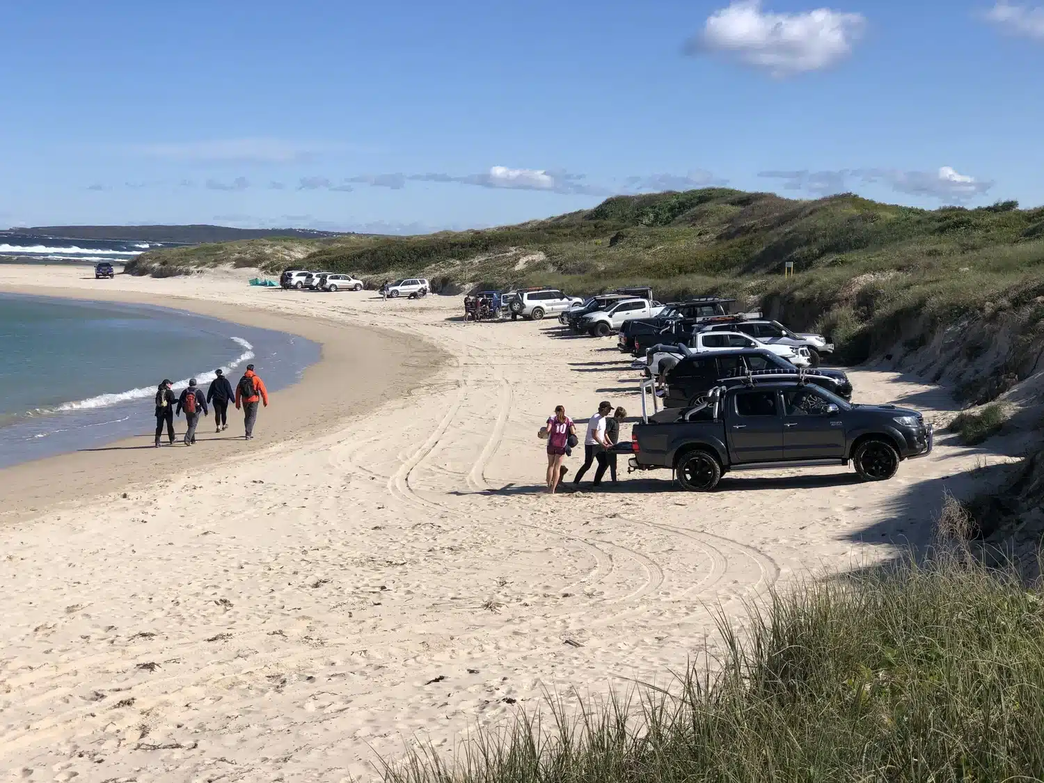
9. Boat Harbour Beach, Kurnell (Silver Beach)
You can drive on a beach in Sydney. Boat Harbour at Kurnell is a 4WD-friendly beach on the southern tip of Sydney. It’s different from other entries because it’s not a bush track – it’s a stretch of sandy beach where you can take the family for a seaside 4WD outing without leaving the city. For beginners, this is perfect. The sand driving here is typically firm and forgiving, the scenery is excellent (views across Botany Bay), and you’ve got the reassurance of being close to help if needed.
Boat Harbour is privately managed (by the Holt Estate) as a 4WD park. The drive itself is about 2 kilometres of beachfront you can cruise. It’s basically a sandy playground – people park up with awnings and BBQs, kids building sandcastles next to lifted LandCruisers. Because it’s on Botany Bay, the water is calm (no big surf), making it safe for swimming. At low tide you might even spot folks digging for pipis. The vibe is friendly – you’ll see first-timers testing their 4WD alongside seasoned drivers just enjoying a relaxed day.
A couple of things to note: It’s open mostly during daylight hours (gates usually 7am-7pm depending on season). It can get busy on weekends. On summer public holidays, they even have a ballot or cap on entries because it’s so popular. Also, no photography drones or commercial filming allowed without permission. Overall, Boat Harbour is as easy-going as 4WDing gets, but it’s noteworthy just for being a Sydney beach you can drive on.
How to get there
From anywhere in Sydney, aim for Kurnell in the Sutherland Shire (the southern headland of Botany Bay). Drive down Captain Cook Drive through the Cronulla/Kurnell industrial area. Just before the Kamay National Park entrance, you’ll see a turn-off with signs for “Boat Harbour 4WD”. There’s a gate where you’ll either show your pre-purchased permit or pay the entry fee (card only, no cash). Staff will let you through, then it’s a sandy track over the dunes and you’re on the beach. You can drive westwards along the beach for a couple of kilometres until you reach the marked boundary. When you’re done, exit the same way. Fuel, food, even fast food are all within 10 minutes (Cronulla shops are close by).
What you’ll need
First, money for the entry fee. Currently it’s about $60 for a day pass. You can also look into a season pass if you’ll visit often. Bring beach essentials: sunscreen, hats, towels, esky with food and drinks. For the 4WD, sand driving basics apply – lower your tyre pressures (15-18 psi), carry a tyre gauge and compressor to reinflate later (there’s a service station in Kurnell village to air up if needed). A long-handled shovel is smart in case you need to dig out. Maxtrax or similar recovery boards are good insurance. If you’re new to sand driving, avoid the temptation to floor it – not only is it frowned upon with families around, but it can bog you quickly. Stick to firm sand, keep momentum if it gets soft, and you’ll be fine. Respect the environment: stay out of the dunes (they’re fenced), and no littering. Facilities are minimal – there are no toilets on the beach itself (there are some at the nearby reserve), so plan accordingly.

10. Yengo National Park (Wollombi Wilderness)
Often overshadowed by the Blue Mountains, Yengo sits quietly to the north-west of Sydney, about 2.5–3 hours drive, offering a mix of Aboriginal history, challenging 4WD trails, and serene campsites. If you want to escape crowds and experience cultural significance with your four-wheel driving, Yengo is excellent.
The park is characterized by big sandstone hills (like the impressive Mount Yengo – a flat-topped mountain that is a sacred site) and valleys of dense bush. One unique aspect: Yengo’s most famous 4WD route, the Big Yango Loop, is within a special precinct behind locked gates. You can get access by booking either Big Yango House or a campground in that precinct through NSW Parks. They’ll give you the lock combination and you’re set for a 22km private 4WD loop. That track delivers steep ascents and descents, with the Buzzards lookout rewarding you with panoramas over the wilderness. It’s rated moderate, but in wet weather it gets challenging.
Outside of Big Yango, there are public trails like the Finchley Track which takes you to Finchley Trig lookout – an easy drive ending with one of the best views in the park and an Aboriginal rock engraving site nearby (don’t miss the incredible rock carvings of Baiame at Finchley Aboriginal Area, signposted off the track).
Camping in Yengo is low-key and peaceful. Finchley Campground is the main spot – it’s small (only a few sites) but usually quiet, and you’ll fall asleep to bush sounds with a sky full of stars. No river or creek here as you’re on a ridge, so bring water. Another option is Mogo Campsite on the western side, near a creek. Yengo feels remote once you’re in it. You might drive for hours without seeing another vehicle. There’s a real sense of being in untouched country. If you’re into heritage, driving the old convict-built Great North Road that borders the park is special too (though much of that is 2WD accessible).

How to get there
Yengo has multiple entry points. A popular approach is via the historic village of Wollombi (in Hunter Valley wine country). From Sydney, drive north to Cessnock or Peats Ridge and then to Wollombi. From Wollombi, head south along Yengo Creek Road to the park entrance. This puts you near Finchley Track. For the Big Yango Loop, you enter from the south via Putty Road – turn off at Howes Valley onto Finchley Road or Yango Track. One well-known route is to start at Bulga (off Putty Road north of Colo Heights) and drive the Yengo Track / Howes Trail eastwards across the park to Wollombi – a fantastic 4WD traverse through the heart of Yengo, around 100km of dirt. If doing Big Yango, you’ll access via Yango Homestead Gate off Finchley Track – coordinates are provided when you book. Always carry a National Park map or download the area on your GPS app. Fuel up at Wollombi, Broke or Laguna depending on direction.
What you’ll need
For Yengo, treat it like any remote 4WD trip. A high-clearance vehicle with low range is required on the 4WD trails (especially Big Yango). In dry weather, most trails are rocky or clay and not too technical; in the wet, some become very slippery. Bring recovery gear. Travelling with a second vehicle is good for safety but not strictly necessary if you’re confident solo (just let someone know your route). Water – bring plenty as none of the camps have it on tap. If camping, you’ll need to be fully self-sufficient (no bins). A compressor will help if you air down for comfort on corrugations. Bring insect repellent – summer evenings can bring out mozzies and march flies in the valleys. A first aid kit is wise, as help is a long way off. If you plan to explore the Aboriginal sites, understanding the cultural significance adds depth to the trip. Have your camera ready – the lookout from Finchley is spectacular at sunset, and you might spot wildlife (wombats, goannas, even dingoes).
So there you have it – 10 excellent 4WD tracks near Sydney that are open for adventure right now. From beach sands to mountain mud, there’s something in this list for every skill level and interest. The best part? You don’t have to trek to the Outback to enjoy them. Grab your keys, load up the 4WD, and get out there. The tracks are calling.
Read More
NSW 4WD tracks close to Sydney: 5 spots for your next weekend escape
Complete guide to 4WD-friendly beaches in NSW
Advertisement