The border is open! Time for a Tasmanian 4X4 Adventure
It’s the perfect time for a Tasmanian 4X4 Adventure now that borders once again open and the warmer months are upon us. Who’s keen on a Tasmanian 4X4 Adventure? The borders are open once again so come along as Kev…
It’s the perfect time for a Tasmanian 4X4 Adventure now that borders once again open and the warmer months are upon us.
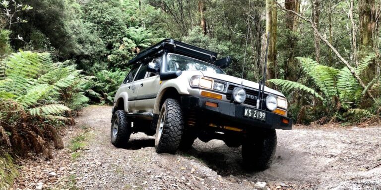
Who’s keen on a Tasmanian 4X4 Adventure? The borders are open once again so come along as Kev Smith explores Tasmania’s wild North West.
Words and photos: Kev Smith
There’s a lot to like about Tasmania. It’s seems like a place where time has stood still, with natural beauty everywhere you look, and there’s also an array of preserved history from when the pioneers opened up Tassie’s remote areas. Tasmania is one of those places where you can zip around on main roads pretty quick and visit the usual touristy spots, but also get away on one of the many off-road tracks that zig-zag the state.
Part of the Hellyer River system.
My starting point on this trip was Hellyer Gorge, about 50km south of Burnie on Tassie’s north coast, heading up into the NW corner. Now while it would have been quicker to shoot up the tar for the 200km easy drive, I was given a heads-up on a few off-road tracks through the forest areas near Campbell Range, with stops along the way including waterfalls and sawmill relics along the Rabalga Track that follows the Arthur River to the west coast.
Hellyer Gorge is popular with tourists these days and it was named after an English surveyor and explorer, Henry Hellyer, who made his way into the harsh and remote environment here in the early 1800s. He mapped and worked through the North West opening up new areas, but it came at a cost: he suffered with depression and eventually he committed suicide in September of 1832 at the young age of 42. He was laid to rest at Stanley after work on the Van Diemen Land project.
Heading west from Hellyer Gorge, along Viney Road, the road winds its way through production forests where care needs to be taken if logging is happening. Plantations through here include quick growing soft pine and gum that are used for pulping and are exported from Burnie, which is the fifth largest industrial port in Australia. I found the route pretty easy to follow in here as Viney Road blended into Farquhars Road, and then into Pioneer Link, but without a good GPS you could be in here for days as forestry roads peel off everywhere and in all directions. Along Pioneer Road there are a couple good alternative tracks bypassing some pretty serious bog holes, which could be handy if you’re travelling solo. These side-tracks are a bit of fun with hillclimbs and a couple of deep gullies, but I’m just not sure if I’d attempt them in the wet, as I reckon track grades would go from fun too hard in no time.
Continuing on, Rabalga Track soon appears and its 4X4 vehicles only with good ruts, dips and creek crossings where the tracks are often lined with tall tree ferns and fallen mossy logs. An impressive stopover on Rabalga Track is Dip Falls where millions of years ago there was volcanic activity in the area and, after weathering, it has left basalt walls for the water to flow over the hexagonal columns.
Across the road from the falls, old relics have been left behind from where there was once a thriving sawmill; the steam boiler has been left here and is easily found. There were only three houses at Dip Falls and the area contained sought-after Blackwood, which was eventually transported by horse and wagon to Mawbanna. It was a valued timber used for furniture and making beer barrels.
Water cascading over the spectacular Dip Falls.
Just up the road at the Big Tree walking track, a 60m tall browntop stringybark towers over the other smaller Cooper ferns and palms. Estimated to be 440 years old, and 16m around, it’s a magnificent and beautiful tree, but it’s slowly decaying from the inside. This tree was left behind by loggers due to its deformities but walking around there is evidence where timber cutters have cut shoe marks into other trees for falling, all this before 1960. The area through here is now protected and no logging occurs in these valleys where moss covers most of the ground and is slowly growing up the tree trunks.
This ‘deformed’ browntop stringybark survived the loggers and is 60m tall!Others trees weren’t so lucky…An old steam boiler is slowly consumed by nature near Dip Falls.
Rabalga Track continues towards the Western Plains area where Eucalypt forests are prominent across the hills and, during the warmer periods, apiary sites have been set up. Honey is big business in Tasmania where nearly 300 tonnes a year is produced, most of it from leatherwood flowers. Crossing over the Pipeline Track there are a couple of locked gates either side. The pipeline beside the track starts at the huge Savage River Mine and heads 90km north to the port carrying iron ore slurry, where it is processed into pellets and exported overseas.
As you hit Trowutta, a sleepy farm area, a good diversion is down to the Trowutta Arch. Signposted as a 20-minute walk, you head down to a cave where a couple of sink holes have formed after rock formations have collapsed into the earth and filled up with water. Around Tassie there are dozens of these sink holes that can appear over time, where dolomite dissolves over thousands of years from undermining subterranean water flows.
Tarwine Arch.
The short drive from Trowutta up towards Edith Creek is on blacktop, but I headed further west from Edith Creek along Poilinna Road, passing huge dairy farms filled with Tassie’s finest milkers, and home to its own dairy factory suppling the region. The farms give way to forest areas where thick tee-tree scrub makes seeing into the forest impossible. In fact, back when the early explores were surveying the area, some called this bush savage country where branches interlocked together. Eventually Poilinna Road intersects with the Bass Highway, but I headed 3km west along the bitumen and then north along the Riseborough Trail past Seventeen Mile Plain.
Along this leg of my Tasmanian 4X4 Adventure, I found quite a few gates that were open but when logging operations are in place they are closed due to safety concerns. Most of the roads in state forests are private, but Forestry Tasmania allows the public access. As you make your way further towards the north west, forests give way to open windswept areas where winds shape the landscape, and this is prominent in the trees used for wind breaks that are often seen leaning to one side, and the low tight shrubs that hug each other. Out here on the north west coast, huge wind farms are now a feature and I saw dozens of these colossal monsters spinning away generating power for the locals.
Ready for harvest.
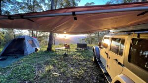
This is Van Diemens Land, where back in the early 1800s a gamble was taken by the English to set up a huge pastoral station, where more than 250,000 acres of land was granted by King George IV to breed sheep for more wool. During that time there was a fine wool shortage, so the hunt was on for more land, but disaster struck and they lost thousands of merino sheep to atrocious weather conditions and wild animal attacks. During this time the nearby settlement of Stanley was set up to control the remote north west coast. While you can’t get right to the tip of the north west, there are commercial tours of the wind farms if you’re keen for a stickybeak. Along the way there are plenty of free camps in the forest as well as out on the coastal fringe towards Montagu on the north coast, with views across Robbins Pass to several islands and then out into Bass Strait; be warned though, when the wind gets up it’s cold and miserable here.
Arthur River entrance.
My Tasmanian 4X4 Adventure took a turn westward along the unsealed Harcus River Road for another hour towards the west coast and on to Marrawah. Look out for the turn-off to Mount Cameron West and the Preminghana Aboriginal Area. You’ll be blown away by the stunning and awe-inspiring views from the lookout at the base of the mountain along the coast, where you can see the wind farms up on the north-west tip and along the coastline. This is Pirapi Aboriginal country where indigenous communities lived and survived for many years off the land and the sea. Today they welcome us to their land here, and it’s a place that has been shaped over many years by these people and the elements, and it is still rich in flora and fauna.
The last leg to Marrawah is an easy drive where camping out at Green Point is permitted but very isolated on the exposed west coast. Lighthouses dot Tassies coastline and Green Point is no exception with its treacherous coastline.
There are several lighthouses all along the coast.
This part of the coast is remote and seems isolated from the rest of the island but only an hour away on the Bass Highway you can be back in civilisation to freshen up for a new journey south, or just to restock. While you’re out on the west coast head south to Arthur River and the viewing point called ‘Edge of the World’, which is the most western spot of Tasmania, with no other land for thousands of miles facing the harsh at times bitterly cold winds.
I thoroughly enjoyed my Tasmanian 4X4 Adventure, passing through active timber logging areas, driving through huge button grass plains, exploring the history and the stunning landscapes that Tassie has to offer, but it’s not until you get off the main tourist routes that this stuff can be found and truly appreciated.
Unsealed 4X4 delivers honest 4WD advice, gear reviews, and travel guides crafted from real Australian adventures. Since 2014, we've tested the gear, driven the tracks, and learned what works - so you can hit the tracks safely.