Advertisement
Advertisement
Technology is here… We reckon you should embrace it! Starting with the VMS 3DX
I grew up staring, wide-eyed and enthusiastic at being the first freckle-faced kid ever to find remote, never-been-seen-before areas of Australia. Plus poking my grubby finger at empty spaces on a map, trying to work out how to get to it with my billy cart and imagining what I might find.
Later, I became a surveyor – a Cadastral Surveyor. I did time in Sydney, Darwin and remote areas. I was marking out the boundaries for various projects: mining leases, train lines, cattle station boundaries and remote area topographical mapping on Islands off the north coast of Australia. My early dreams came true!
All these jobs were done the “hard way”. There was no electronic measuring gear. No ready access GPS navigation units, or any easy way of knowing where I was or where I needed to get to. So the old sextant lessons came in handy!
Fast forward some twenty-something years since my last surveying gig. My smartphone and various navigation equipment can do much more than ever imagined. Plus it’s faster, easier and more accurate.
While I’ve dabbled in and tested electronic navigation gear, it was when I started playing with the latest VMS 3DX navigator that I started enjoying the various systems it offers. Yes, I know there are other systems around, but to date, one of the attributes I like about the VMS system is its simplicity. I turn it on, set a few parameters and intuitively know what to do. Well, mostly. Some others need a degree to understand how to get the most out of them. Given most blokes don’t bother with the instructions, they tend not to know how they work.

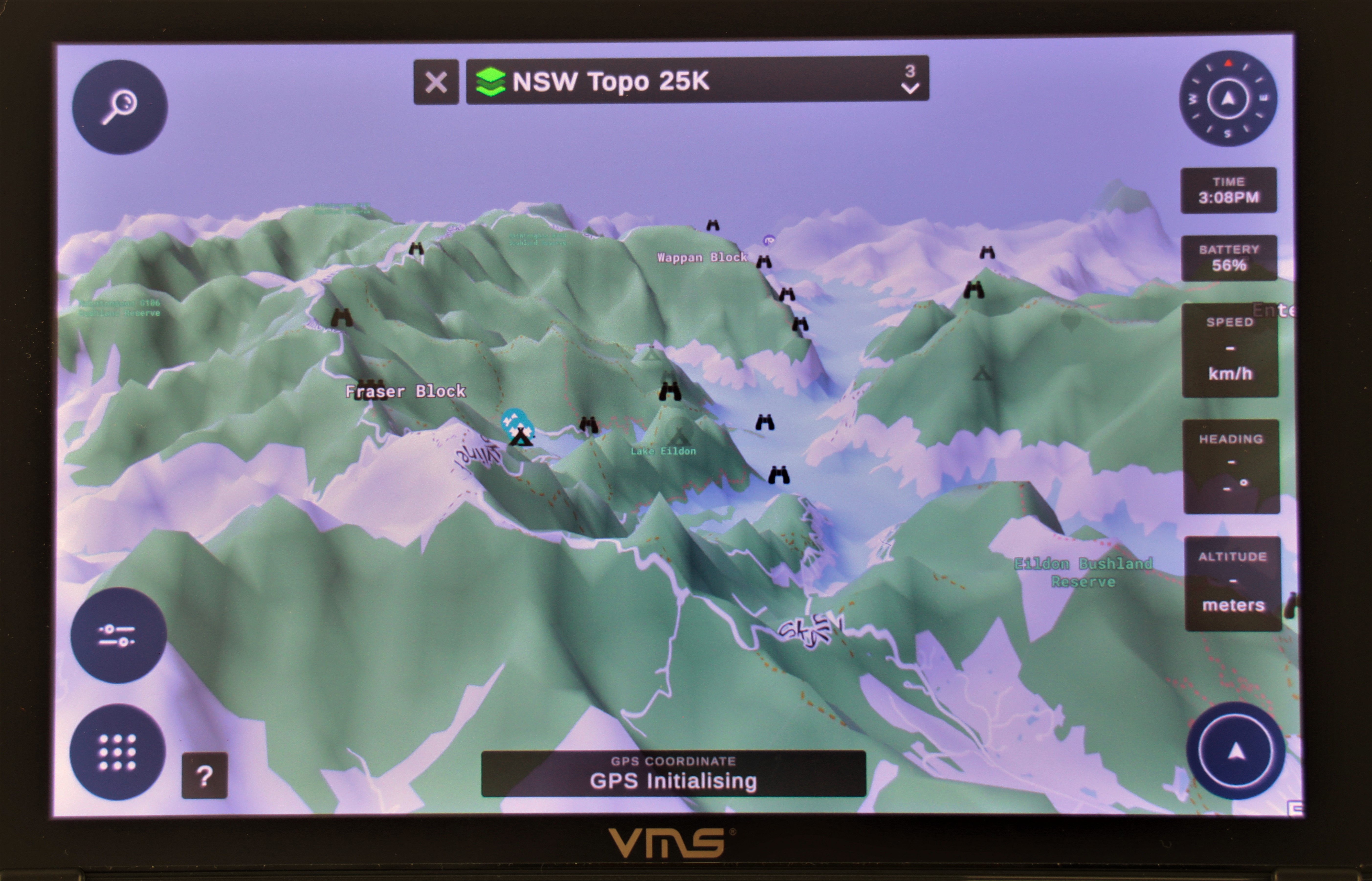
A few attributes that set the 3DX apart from the pack are as follows. The adjustable three-dimensional aspect returns a life-like view of any terrain, visually helping to understand what the driver is about to negotiate. In addition, being adjustable allows the vertical axis to be tweaked by the user to best show the topography ahead. The true ‘lay-of-the-land’. That’s a convenient feature for those less accustomed to reading contour lines and spot heights on a map. For those more versed in map reading; it gives a sense of reality.
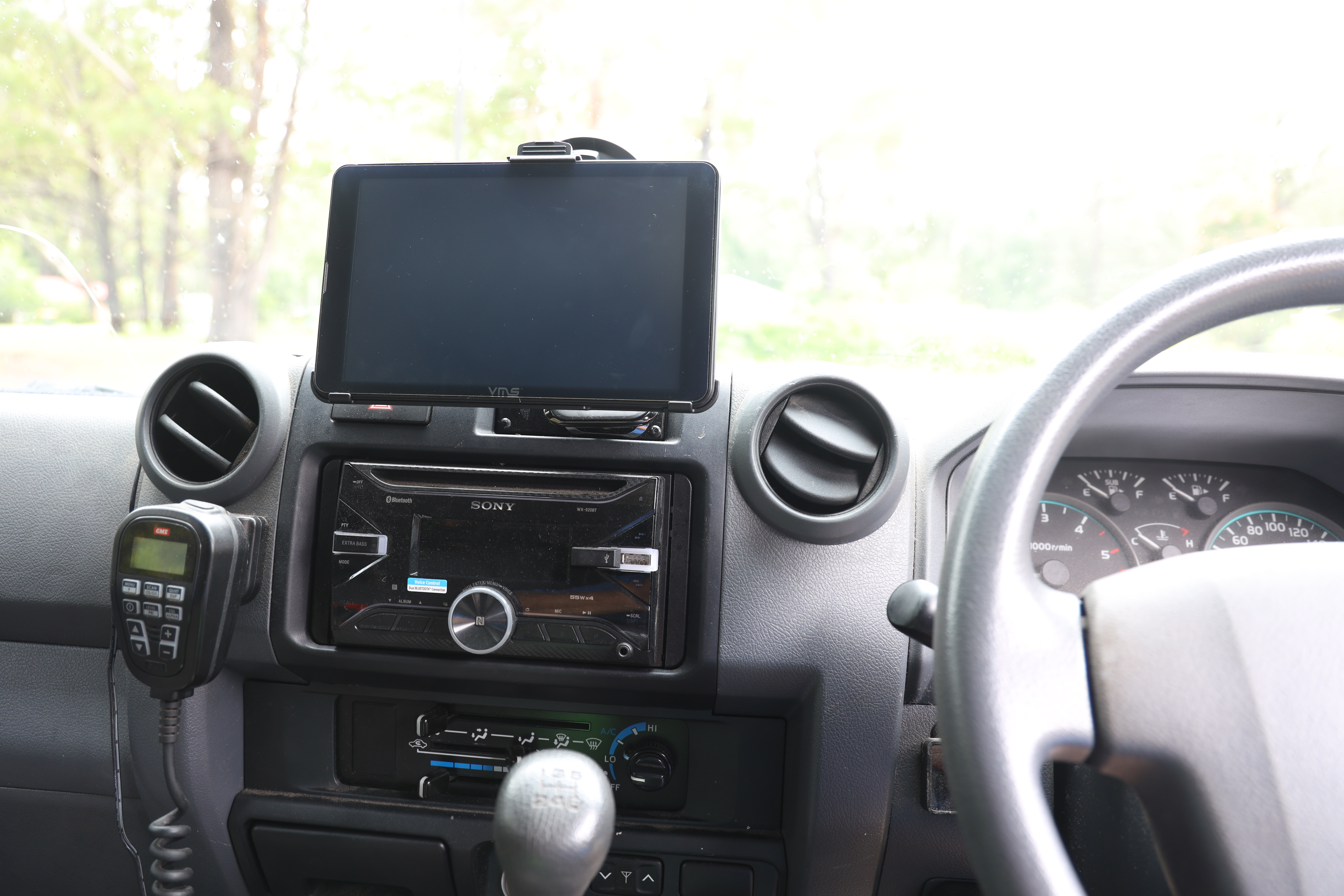
The information is detailed and easily read, given the sizable eight-inch screen with bright, high-definition imaging.

The only drawback of the VMS 3DX system is the lack of an advanced on-road street navigation system. The 3DX was not designed for that purpose, and the makers freely admit that.
While a basic street navigation system is included, it simply doesn’t have all the bells and whistles that others provide. The 3DX will still deliver speech and turn-by-turn navigation around the streets. You only miss out on street-level, detailed views of multiple lanes. Instead, a simplified overhead view with the pointer indicating where you are on the map is shown.
My thoughts on this are that it’s easily overcome with Google maps and the plethora of smartphone apps that can be downloaded. They are perfect for street navigation and limited off-road use when you have phone reception. But, after that, the VMS3DX takes over and doesn’t look back. Well, it can look back, sideways forward and in any direction.

Feel free to hop onto www.VMS4x4.com to read all the technical features, of which there are many, but let’s outline a few of the more important and most 4X4-orientated attributes.
Three-dimensional vector maps return life-like views of the terrain you are driving on in real-time and allow a much faster, more detailed, and multi-dimensional mapping experience over the older system. In addition, it will enable you to zoom into tracks and features with no loss of clarity. That makes it a winner.
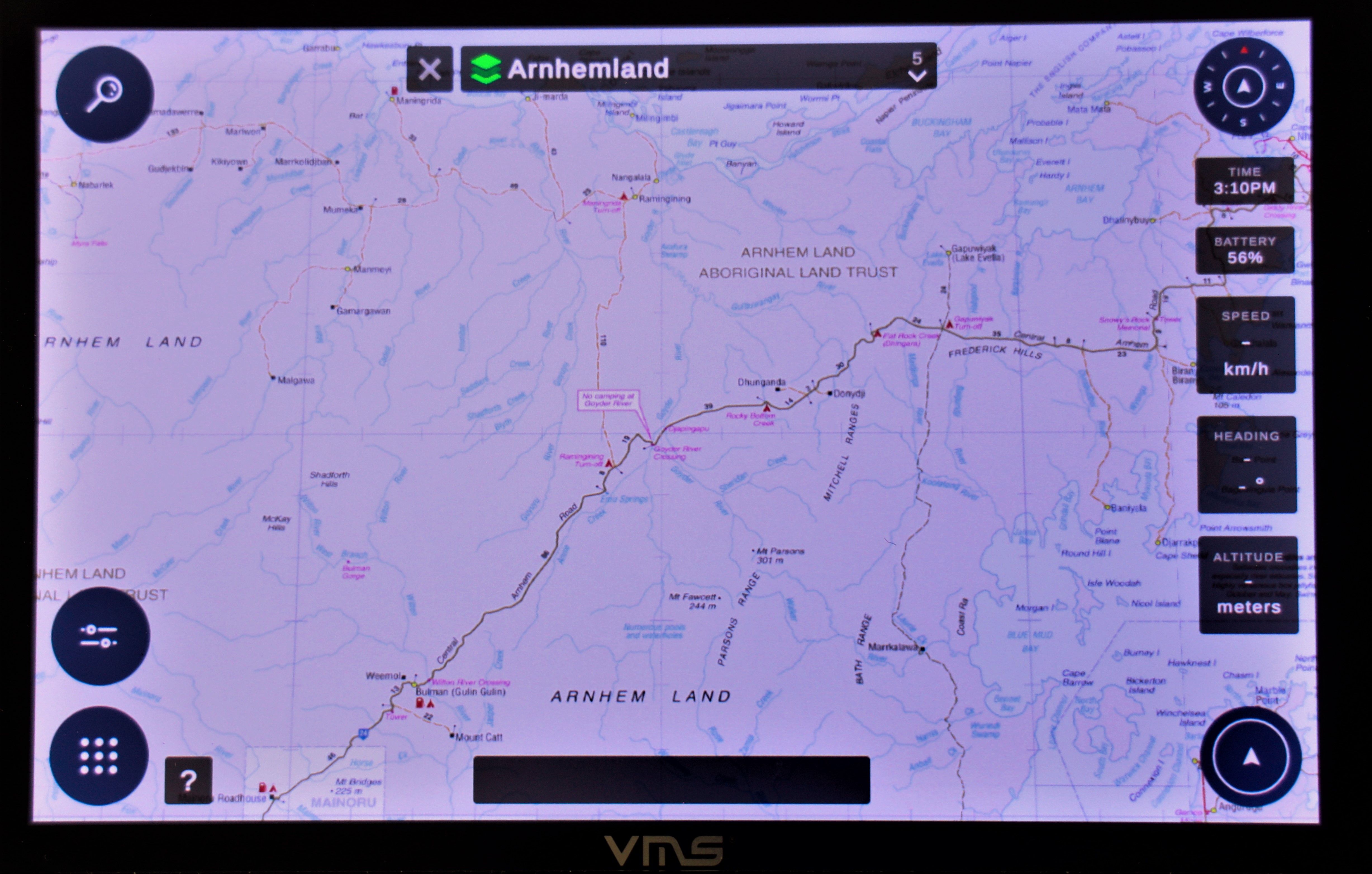
A straightforward navigation mode handles all your navigation. There is no need to switch between on and off-road modes. The 3DX incorporates CAMPS11 and caravan Parks 6, meaning an abundance of behind-the-scenes information to allow the user to search and navigate. No more online searching of camping spots, caravan parks or places of interest on your phone, if you’re lucky enough to have reception, flipping pages in a book, and trying to cross-reference to a navigator. It’s all loaded in the 3DX to make life less frustrating at finding almost any feature.
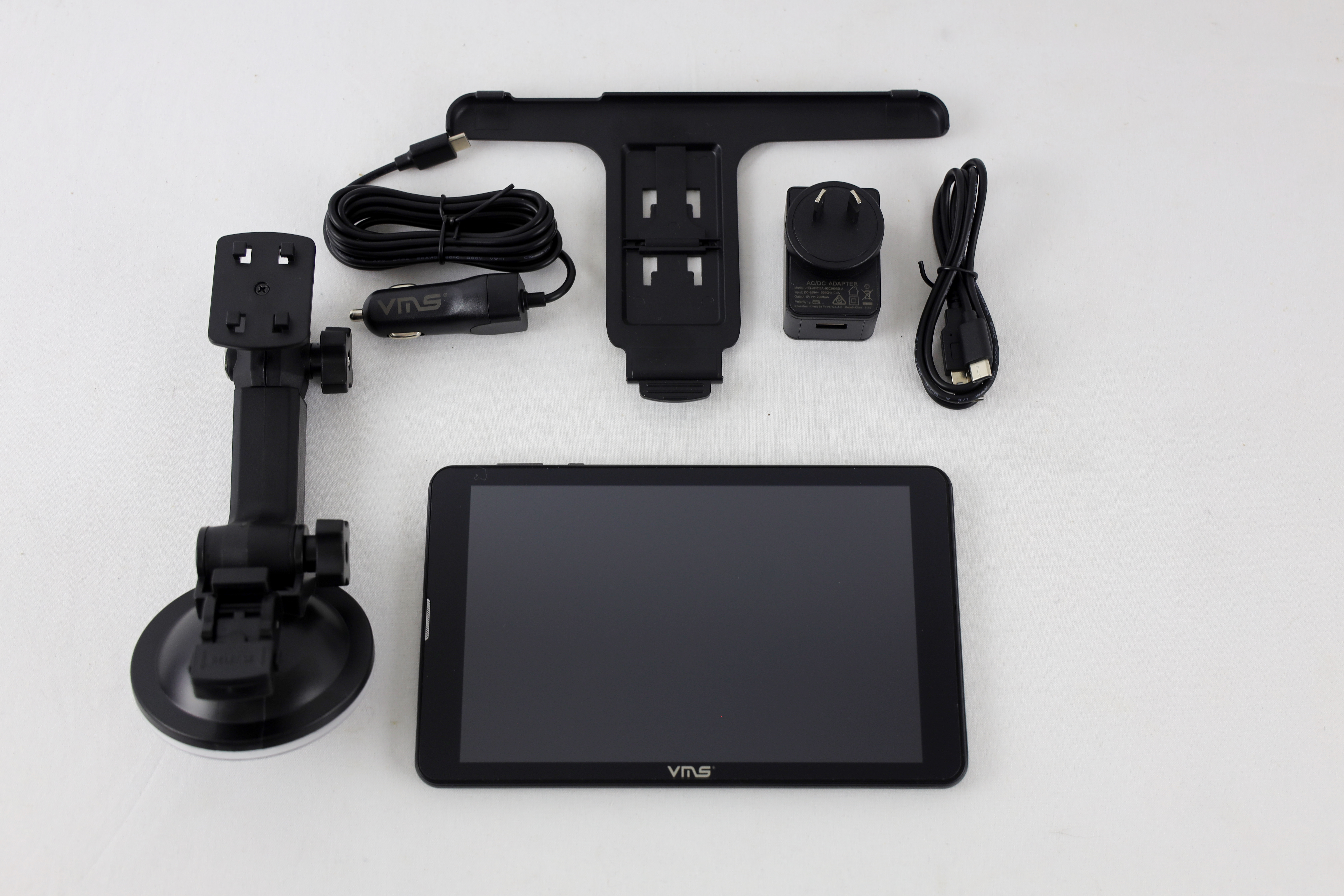
While the aforementioned large eight-inch (20.32 cm) is a great feature, the Bluetooth-enabled 1200 x 800 dpi screen allows all that information to be viewed. The 4000mAh battery is class-leading, allowing for more extended use while unplugged. Not that you would want to go hiking with this unit, but it is helpful while relaxing around camp to plot the next day’s adventure. There is also a 5-meg camera built-in, allowing happy snaps to be added to your journey. The internal memory of 32GB with expandable (via micro-SD card) up to 128GB provides plenty of different mapping to be installed if needed. A reversing camera can also be hooked up to the unit. This allows great rear views while parking, hitching up the camper trailer and ensuring you don’t run over anything or anyone.
The system comes preloaded with Australia-wide mapping, but state and area-based, more detailed maps can be purchased and uploaded anytime. Great for when you need a concentrated area to explore.
The system is updatable via Wi-Fi, so any future software and map updates are easily uploaded.

While I haven’t trekked across the Simpson Desert, climbed to Cape York or dipped my way down to Tassie with the VMS 3DX yet, the usage I’ve put it through, in both my known local tracks, as well as further afield, has proven it to be a most helpful navigation tool. Or, in layman’s terms, it’s bloody fantastic!
Take, for instance, my local State Forest. While shuttling my sons and their mountain bikes around the crisscrossing tracks, I could easily track where we were. I could also set waypoints for particular jumps, as they wanted photographs of them launching skywards. This made it exceptionally easy to re-find. Plus the turn-by-turn speech navigation on the dirt tracks made life much easier. How comforting it would be to have this navigation system tell me that I would need to turn onto the French Line in the Simpson Desert, the Old Telegraph Track in Cape York, or the Mount Huxley track near Queenstown, Tassie. Knowing and being told of upcoming turns in the bush, rather than just seeing a pointer on the map, is a massive advantage to ensuring you’re staying on the planned route.
I’ve found the 3DX navigator self-explanatory, easy to use, and extraordinarily fast to fire up for use. Push the ON button, and there’s very little time to wait until you see the mapping system. There aren’t too many adjustments to be made, which, to be honest, I’m relieved at. Too many other systems need a degree to work out and I don’t have one of those!
Given the simplicity, there is still a heap of online tutorials, including the “Top 10 things to do when you get your 3DX” instructions, which pretty much rounds out all you need to know.
The VMS3DX is a winner in many ways and will have a place in my 4WD from hereon in to help navigate my way around the country, play on my local tracks and explore the unknown.
For pricing and more information, check out www.VMS4x4.com or call (03) 9017 5589.