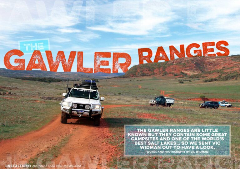
Mention the Gawler Ranges to most people and you tend to get a blank stare back at you. I’ve been visiting this area and including it on various Outback itineraries for a few years now and I reckon it’s a spot well worth a few days of your time. The Gawler Ranges are located about two hours drive west of Port Augusta in South Australia. The downside (or upside depending on your preference) of the area is it is rather isolated – so make sure you have plenty of fuel on board and stock up the supplies in Port Augusta before heading out. I always leave the sealed Eyre Highway at the old mining town of Iron Knob to follow the dusty unsealed road for 120km to Mt Ive Station before actually heading into the ranges; but if your 4X4 has a small fuel tank you might continue down the Eyre Highway for another 87 klicks to the town of Kimba where you can pick up more fuel before heading bush.
Because the Gawler Ranges lie just north of the Eyre Highway as it commences its long stretch across the Nullarbor Plain, it is also possible to continue west on the highway and access the National Park from various feeder roads. But, as mentioned, I like to leave the main road at Iron Knob after a short diversion into the old mining town – where you should seek out the visitor centre to see a collection of old mining relics and watch its short video on the history of mining at Iron Knob.
The route you follow from Iron Knob through vast sheep stations such as Siam and Nonning actually follows the route taken by the first European explorer John Eyre who walked through here in 1839. In fact, for the keen-eyed traveller, you will see a couple of trackside plaques commemorating a couple of his camps along the road towards Mt Ive Station. This is tough and semi-arid land, but back in the mid 1800s it must have experienced several good seasons as it presented itself with vast grassy plains and numerous waterholes. This prompted the government of the day to declare that land being used by farmers had to run at least 50 sheep per square mile and this saw in excess of 90,000 sheep being shorn in the region. Of course, the good times did not last. When the land returned to its dry state, it suffered from overstocking. Sheep are still raised on the numerous stations along the edge of the Gawler Ranges; but in far more manageable numbers these days.
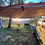
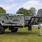
Any trip to the Gawler Ranges has to include a few nights at Mt Ive Station which is easily found – just keep driving on the Nonning road until you see a large black submarine! That’s right, there is a submarine at the entrance to Mt Ive Station, half buried in the red earth – you can’t miss it. Mt Ive offers a lot more than just great campsites (which, by the way, are level and adjacent to hot showers and flushing toilets just across the road from the station’s kiosk where you can buy basic supplies).
Mt Ive has developed some great 4X4 tracks for you to follow; there is a small fee for the privilege but it’s certainly worth it. A couple of these tracks take you around the vast property with low range required occasionally due to the steep rocky nature of the terrain. Each of them leads you to fascinating rock structures known as Rhyolite columns… the Gawler Ranges are well known for these organ pipe-like formations. The standout drive on Mt Ive Station is the one out to the vast Lake Gairdner.
This salt lake is the third-largest in Australia and measures a staggering 160km long by 48km at its widest section. For the majority of the year it is a blindingly white expanse that shimmers in the sunlight. Occasionally after rain it is covered in very shallow water, which reflects the sky like a mirror. I always plan my visits towards sunset to see some amazing vistas across this beautiful landscape.
Lake Gairdner is also the scene of dry salt-lake racers who meet there each March to see just how fast their machines can go. Similar to the famous Bonneville salt lakes in the USA, Lake Gairdner has a worldwide reputation as one of the best locations for world land speed record attempts.
I have used Mt Ive Station and its excellent facilities as a base to explore the nearby Gawler Ranges but the National Park also offers several good campsites to entice you to stay. Here is a round trip, that I have done a few times, which takes in the best of the Ranges.
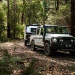
Leaving Mt Ive head out past the turn-off to the Lake towards Thurlga (another sheep station) then turn east back towards Kimba. After 30km of dusty road travel you will see the entrance to the National Park on your right. Here the road deteriorates and whilst it’s easily accomplished in dry conditions in high range, the tracks will turn to mush in wet weather and the park is usually closed to access at these times.
On entering the park near the Paney Homestead (the park consists of previous sheep stations that have been acquired by the South Australian Government) you will see the self-registration booth. It costs $10 per vehicle to enter the park and if you decide to camp there is an extra $11 fee per vehicle per day. Fortunately, the dreaded booking online system has not encroached this remote park – so you can still just turn up and book your site when it suits you.
The road network around the National Park forms a large figure eight. I have found the best route to follow is off to the right at Paney which follows the low hills typical of the Gawler Ranges to a nice campsite at Kolay Hut. The hut provides some shelter for a couple but the adjacent campground alongside the dry creek will accommodate three or four vehicles. Just up the road from the Hut is the impressive Kolay Mirica Falls. Now don’t expect too much water, there was just a trickle on my last visit; but the short walking track from the car park to the Falls leads across a rock shelf surrounded by an amphitheatre of Rhyolite columns, which makes for a very impressive sight.
A few kilometres further on, after the track climbs over a ridge and drops down into another long and wide valley, I suggest you turn left towards Mattera campsite. This area is about two kilometres off the through-road in a sheltered valley below some low hills; it has a large level area amongst the native trees and is rarely visited, so it makes an ideal remote campsite (there’s even a long drop dunny).
This through-road leads out to another road that actually joins the eastern end of the park with the western end – and it is signposted as the Old Paney Scenic Route. We saw lots of kangaroos along here on my last visit, together with quite a few wedgetail eagles and a few emus. The Old Paney Homestead is certainly worth a stop and a few minutes to look around. There is an old stone water tank nearby too.
A good side trip is found where the Old Paney Scenic Route joins the Yardea road; it leads to a site known as the organ pipes. It took us a little bit to find as there were a couple of false starts … but just try each of the side roads you find and (using your Hema map) you will eventually get on the right track. It is rough in places; not hard, just requiring less speed and careful wheel placement. It ends in a small car park and then it’s time to take a walk. The exercise is good for you and the reward of the large gorge and surrounding cliffs is worth the effort. I climbed to the top of the Falls (again, not a lot of water) for a commanding view over the surrounding countryside.
The Yardea road leads back to Mt Ive Station, or you can keep left towards Kingoonya and camp on the western side of Lake Gairdner in a nice National Park camping ground not far up the Kingoonya road.
So if you have time on your way over to the west or when you’re out to drive Goog’s Track, allow a few extra days to visit the Gawler Ranges. I’m sure you will agree they are quite different. And like me, you will probably have them all to yourself.
Words and photography by Vic Widman
[/read]